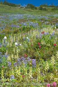
Paradise Meadows wildflowers, summer.
Location: Paradise Meadows, Mount Rainier National Park, Washington
Image ID: 13892
Location: Paradise Meadows, Mount Rainier National Park, Washington
Image ID: 13892
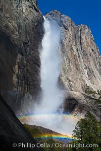
Yosemite Falls and double rainbow, full on and all the way, viewed from the Yosemite Falls trail, spring.
Location: Yosemite Falls, Yosemite National Park, California
Image ID: 27743
Location: Yosemite Falls, Yosemite National Park, California
Image ID: 27743
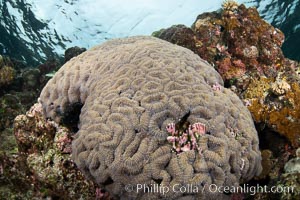
Symphyllia brain coral on tropical coral reef, Fiji.
Location: Vatu I Ra Passage, Bligh Waters, Viti Levu Island, Fiji
Image ID: 35029
Location: Vatu I Ra Passage, Bligh Waters, Viti Levu Island, Fiji
Image ID: 35029
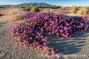
Desert Sand Verbena in June Wash During Unusual Winter Bloom in January, fall monsoon rains led to a very unusual winter bloom in December and January in Anza Borrego Desert State Park in 2022/2023.
Location: Anza-Borrego Desert State Park, Borrego Springs, California
Image ID: 39029
Location: Anza-Borrego Desert State Park, Borrego Springs, California
Image ID: 39029
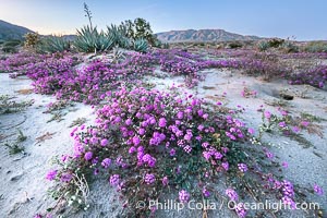
Desert Sand Verbena in June Wash During Unusual Winter Bloom in January, fall monsoon rains led to a very unusual winter bloom in December and January in Anza Borrego Desert State Park in 2022/2023.
Location: Anza-Borrego Desert State Park, Borrego Springs, California
Image ID: 39032
Location: Anza-Borrego Desert State Park, Borrego Springs, California
Image ID: 39032
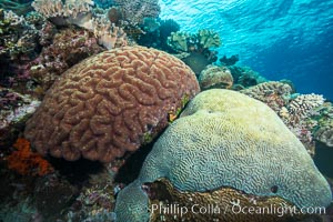
Brain corals on tropical coral reef, Fiji. Left brain coral is Symphllia, right bain coral is Platygyra lamellina.
Species: Brain coral, Platygyra lamellina, Symphyllia
Location: Vatu I Ra Passage, Bligh Waters, Viti Levu Island, Fiji
Image ID: 31702
Species: Brain coral, Platygyra lamellina, Symphyllia
Location: Vatu I Ra Passage, Bligh Waters, Viti Levu Island, Fiji
Image ID: 31702
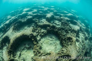
Curious underwater terrain, Lake Tahoe, California.
Location: Lake Tahoe, California
Image ID: 32319
Location: Lake Tahoe, California
Image ID: 32319
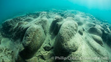
Curious underwater terrain, Lake Tahoe, California.
Location: Lake Tahoe, California
Image ID: 32320
Location: Lake Tahoe, California
Image ID: 32320
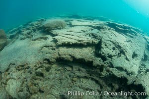
Curious underwater terrain, Lake Tahoe, California.
Location: Lake Tahoe, California
Image ID: 32321
Location: Lake Tahoe, California
Image ID: 32321
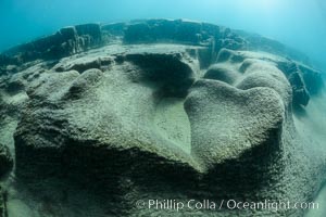
Curious underwater terrain, Lake Tahoe, California.
Location: Lake Tahoe, California
Image ID: 32322
Location: Lake Tahoe, California
Image ID: 32322
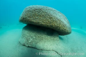
Curious underwater terrain, Lake Tahoe, California.
Location: Lake Tahoe, California
Image ID: 32323
Location: Lake Tahoe, California
Image ID: 32323
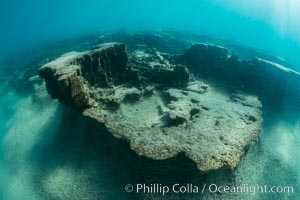
Curious underwater terrain, Lake Tahoe, California.
Location: Lake Tahoe, California
Image ID: 32324
Location: Lake Tahoe, California
Image ID: 32324
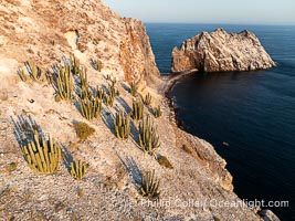
Rugged Terrain of Isla San Pedro Martir, Sea of Cortez. Aerial photo. The large bird population deposits enormous quantities of guano on the island, resulting in the white appearance of the island contrasted with sparse vegetation. In the late 19th and early 20th century guano was heavily mined off the island and shipped as far as Europe for use as fertilizer. San Pedro Martir is seldom visited, having near vertical sides leaving only questionable fair weather anchorages in two locations. Landing access was possible near a small isthmus in the southeast of the island, but is now forbidden. In 2005, the island was classified along with 244 others as a World Heritage Site by UNESCO, and included in the Islands and Protected Areas of the Gulf of California.
Location: Isla San Pedro Martir, Sonora, Mexico
Image ID: 40400
Location: Isla San Pedro Martir, Sonora, Mexico
Image ID: 40400
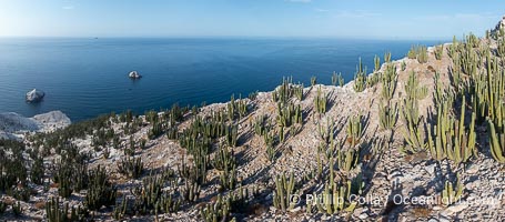
Rugged Terrain of Isla San Pedro Martir, Sea of Cortez. Aerial photo. The large bird population deposits enormous quantities of guano on the island, resulting in the white appearance of the island contrasted with sparse vegetation. In the late 19th and early 20th century guano was heavily mined off the island and shipped as far as Europe for use as fertilizer. San Pedro Martir is seldom visited, having near vertical sides leaving only questionable fair weather anchorages in two locations. Landing access was possible near a small isthmus in the southeast of the island, but is now forbidden. In 2005, the island was classified along with 244 others as a World Heritage Site by UNESCO, and included in the Islands and Protected Areas of the Gulf of California.
Location: Isla San Pedro Martir, Sonora, Mexico
Image ID: 40421
Panorama dimensions: 4451 x 10130
Location: Isla San Pedro Martir, Sonora, Mexico
Image ID: 40421
Panorama dimensions: 4451 x 10130
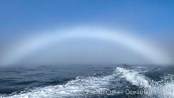
A fog bow, sometimes called a white rainbow, is a similar phenomenon to a rainbow; however, as its name suggests, it appears as a bow in fog rather than rain.
Location: Coronado Islands (Islas Coronado), Baja California, Mexico
Image ID: 38578
Location: Coronado Islands (Islas Coronado), Baja California, Mexico
Image ID: 38578
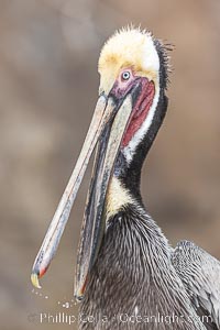
Brown Pelican Portrait Clapping Its Jaws, drops of water frozen in mid air between the tips of its bill, adult winter breeding plumage, feathers wet from rain.
Species: Brown Pelican, Pelecanus occidentalis, Pelecanus occidentalis californicus
Location: La Jolla, California
Image ID: 38910
Species: Brown Pelican, Pelecanus occidentalis, Pelecanus occidentalis californicus
Location: La Jolla, California
Image ID: 38910
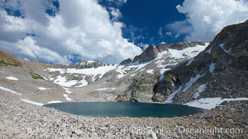
Nameless Lake (10709'), surrounded by glacier-sculpted granite peaks of the Cathedral Range, near Vogelsang High Sierra Camp.
Location: Yosemite National Park, California
Image ID: 23205
Location: Yosemite National Park, California
Image ID: 23205
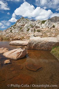
Alpine pond and ridge near Vogelsang Peak, near Vogelsang Pass (10685') in Yosemite's high country.
Location: Yosemite National Park, California
Image ID: 23215
Location: Yosemite National Park, California
Image ID: 23215
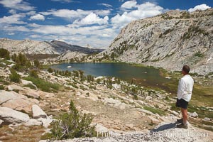
Hiker views Vogelsang Lake and the western buttress of Fletcher Peak from a vantage point near Vogelsang Pass, looking north.
Location: Yosemite National Park, California
Image ID: 23216
Location: Yosemite National Park, California
Image ID: 23216

Panoramic view from Vogelsang Pass (10685') in Yosemite's high country, looking south. Visible on the left are Parson's Peak (12147'), Gallison Lake and Bernice Lake in the Cathedral Range, the Clark Range is in the distant middle, while Vogelsang Peak (11516') rises to the right.
Location: Yosemite National Park, California
Image ID: 23222
Panorama dimensions: 2976 x 16765
Location: Yosemite National Park, California
Image ID: 23222
Panorama dimensions: 2976 x 16765

Panorama of Vogelsang basin, surrounding Vogelsang Lake in Yosemite's High Sierra, viewed from near Vogelsang Pass. Left is Vogelsang Peak (11516'), Choo-choo Ridge is in the distant middle, and the western flank of Fletcher Peak is to the right.
Location: Yosemite National Park, California
Image ID: 23231
Panorama dimensions: 5075 x 16023
Location: Yosemite National Park, California
Image ID: 23231
Panorama dimensions: 5075 x 16023
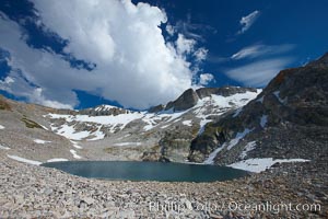
Nameless Lake (10709'), surrounded by glacier-sculpted granite peaks of the Cathedral Range, near Vogelsang High Sierra Camp.
Location: Yosemite National Park, California
Image ID: 23245
Location: Yosemite National Park, California
Image ID: 23245
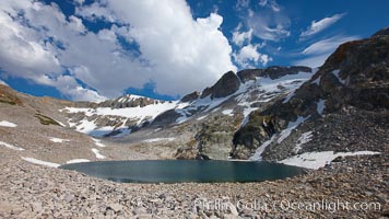
Nameless Lake, surrounded by glacier-sculpted granite peaks of the Cathedral Range, near Vogelsang High Sierra Camp.
Location: Yosemite National Park, California
Image ID: 23255
Location: Yosemite National Park, California
Image ID: 23255
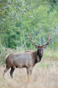
Roosevelt elk, adult bull male with large antlers. Roosevelt elk grow to 10' and 1300 lb, eating grasses, sedges and various berries, inhabiting the coastal rainforests of the Pacific Northwest.
Species: Roosevelt elk, Cervus canadensis roosevelti
Location: Redwood National Park, California
Image ID: 25883
Species: Roosevelt elk, Cervus canadensis roosevelti
Location: Redwood National Park, California
Image ID: 25883
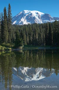
Mount Rainier rises above Reflection Lake, afternoon.
Location: Reflection Lake, Mount Rainier National Park, Washington
Image ID: 13851
Location: Reflection Lake, Mount Rainier National Park, Washington
Image ID: 13851
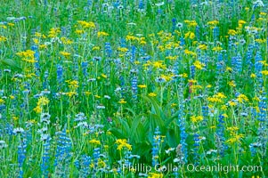
Paradise Park hosts a rich display of wildflowers each summer.
Location: Paradise Meadows, Mount Rainier National Park, Washington
Image ID: 13916
Location: Paradise Meadows, Mount Rainier National Park, Washington
Image ID: 13916
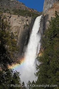
Bridalveil Falls with a rainbow forming in its spray, dropping 620 into Yosemite Valley, displaying peak water flow in spring months from deep snowpack and warm weather melt. Yosemite Valley.
Location: Bridalveil Falls, Yosemite National Park, California
Image ID: 16176
Location: Bridalveil Falls, Yosemite National Park, California
Image ID: 16176
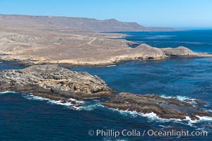
San Clemente Island, rugged barren coastline and island terrain surrounded by lush underwater kelp forests and marine life.
Location: San Clemente Island, California
Image ID: 25983
Location: San Clemente Island, California
Image ID: 25983
