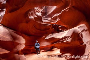
A hiker admiring the striated walls and dramatic light within Antelope Canyon, a deep narrow slot canyon formed by water and wind erosion.
Location: Navajo Tribal Lands, Page, Arizona
Image ID: 18009
Location: Navajo Tribal Lands, Page, Arizona
Image ID: 18009
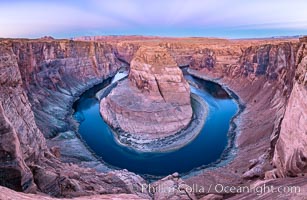
Belt of Venus over Horseshoe Bend on the Colorado River. The Colorado River makes a 180-degree turn at Horseshoe Bend. Here the river has eroded the Navajo sandstone for eons, digging a canyon 1100-feet deep. The Belt of Venus, or anti-twilight arch, is the shadow of the earth cast upon the atmosphere just above the horizon, and occurs a few minutes before sunrise or after sunset.
Location: Page, Arizona
Image ID: 37781
Panorama dimensions: 5719 x 8788
Location: Page, Arizona
Image ID: 37781
Panorama dimensions: 5719 x 8788
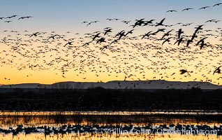
Snow geese fly in huge numbers at sunrise. Thousands of wintering snow geese take to the sky in predawn light in Bosque del Apache's famous "blast off". The flock can be as large as 20,000 geese or more.
Species: Snow goose, Chen caerulescens
Location: Bosque del Apache National Wildlife Refuge, Socorro, New Mexico
Image ID: 38742
Species: Snow goose, Chen caerulescens
Location: Bosque del Apache National Wildlife Refuge, Socorro, New Mexico
Image ID: 38742
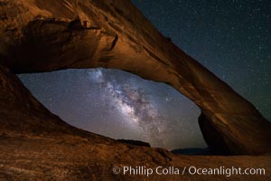
Milky Way and Stars through Wilson Arch. Wilson Arch rises high above route 191 in eastern Utah, with a span of 91 feet and a height of 46 feet.
Location: Wilson Arch, Moab, Utah
Image ID: 29275
Location: Wilson Arch, Moab, Utah
Image ID: 29275
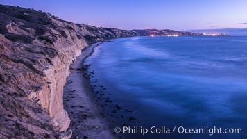
Torrey Pines cliffs at sunset.
Location: Torrey Pines State Reserve, San Diego, California
Image ID: 29112
Location: Torrey Pines State Reserve, San Diego, California
Image ID: 29112
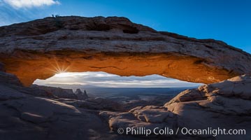
Mesa Arch Sunrise, Canyonlands National Park, Utah.
Location: Mesa Arch, Canyonlands National Park, Utah
Image ID: 29304
Location: Mesa Arch, Canyonlands National Park, Utah
Image ID: 29304
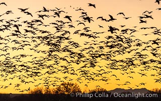
Snow geese fly in huge numbers at sunrise. Thousands of wintering snow geese take to the sky in predawn light in Bosque del Apache's famous "blast off". The flock can be as large as 20,000 geese or more.
Species: Snow goose, Chen caerulescens
Location: Bosque del Apache National Wildlife Refuge, Socorro, New Mexico
Image ID: 38715
Species: Snow goose, Chen caerulescens
Location: Bosque del Apache National Wildlife Refuge, Socorro, New Mexico
Image ID: 38715
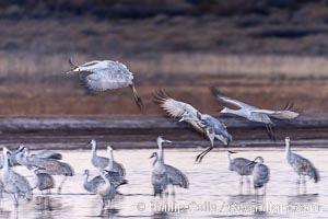
Sandhill cranes landing in water ponds at dusk, spending the night standing in water as a protection against coyotes and other predators. Motion blur.
Species: Sandhill crane, Grus canadensis
Location: Bosque del Apache National Wildlife Refuge, Socorro, New Mexico
Image ID: 38731
Species: Sandhill crane, Grus canadensis
Location: Bosque del Apache National Wildlife Refuge, Socorro, New Mexico
Image ID: 38731
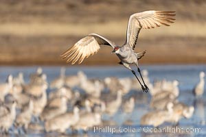
Sandhill Cranes in Flight at Sunrise, Bosque del Apache NWR. At sunrise, sandhill cranes will fly out from the pool in which they spent the night to range over Bosque del Apache NWR in search of food, returning to the pool at sunset.
Species: Sandhill crane, Grus canadensis
Location: Bosque del Apache National Wildlife Refuge, Socorro, New Mexico
Image ID: 38733
Species: Sandhill crane, Grus canadensis
Location: Bosque del Apache National Wildlife Refuge, Socorro, New Mexico
Image ID: 38733
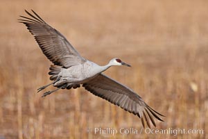
Sandhill crane in flight, wings extended.
Species: Sandhill crane, Grus canadensis
Location: Bosque Del Apache, Socorro, New Mexico
Image ID: 26197
Species: Sandhill crane, Grus canadensis
Location: Bosque Del Apache, Socorro, New Mexico
Image ID: 26197
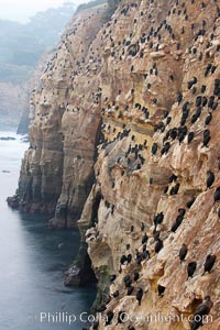
Cormorants rest on sandstone seacliffs above the ocean. Likely Brandts and double-crested cormorants.
Species: Cormorants, Phalacrocorax
Location: La Jolla, California
Image ID: 18345
Species: Cormorants, Phalacrocorax
Location: La Jolla, California
Image ID: 18345
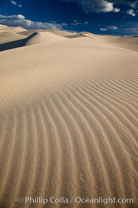
Eureka Dunes. The Eureka Valley Sand Dunes are California's tallest sand dunes, and one of the tallest in the United States. Rising 680' above the floor of the Eureka Valley, the Eureka sand dunes are home to several endangered species, as well as "singing sand" that makes strange sounds when it shifts. Located in the remote northern portion of Death Valley National Park, the Eureka Dunes see very few visitors.
Location: Eureka Dunes, Death Valley National Park, California
Image ID: 25250
Location: Eureka Dunes, Death Valley National Park, California
Image ID: 25250
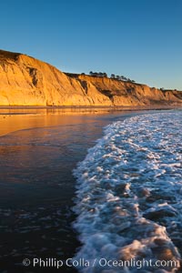
Torrey Pines State Beach, sandstone cliffs rise above the beach at Torrey Pines State Reserve.
Location: Torrey Pines State Reserve, San Diego, California
Image ID: 27248
Location: Torrey Pines State Reserve, San Diego, California
Image ID: 27248
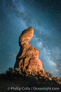
Balanced Rock and Milky Way stars at night.
Location: Balanced Rock, Arches National Park, Utah
Image ID: 27835
Location: Balanced Rock, Arches National Park, Utah
Image ID: 27835
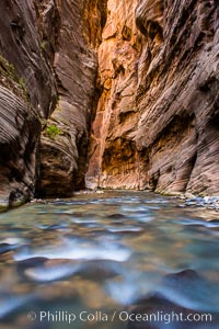
The Virgin River Narrows, where the Virgin River has carved deep, narrow canyons through the Zion National Park sandstone, creating one of the finest hikes in the world.
Location: Virgin River Narrows, Zion National Park, Utah
Image ID: 28578
Location: Virgin River Narrows, Zion National Park, Utah
Image ID: 28578
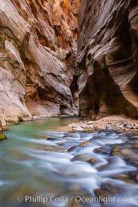
The Virgin River Narrows, where the Virgin River has carved deep, narrow canyons through the Zion National Park sandstone, creating one of the finest hikes in the world.
Location: Virgin River Narrows, Zion National Park, Utah
Image ID: 28579
Location: Virgin River Narrows, Zion National Park, Utah
Image ID: 28579
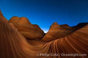
The Wave at Night, under a clear night sky full of stars. The Wave, an area of fantastic eroded sandstone featuring beautiful swirls, wild colors, countless striations, and bizarre shapes set amidst the dramatic surrounding North Coyote Buttes of Arizona and Utah. The sandstone formations of the North Coyote Buttes, including the Wave, date from the Jurassic period. Managed by the Bureau of Land Management, the Wave is located in the Paria Canyon-Vermilion Cliffs Wilderness and is accessible on foot by permit only.
Location: North Coyote Buttes, Paria Canyon-Vermilion Cliffs Wilderness, Arizona
Image ID: 28621
Location: North Coyote Buttes, Paria Canyon-Vermilion Cliffs Wilderness, Arizona
Image ID: 28621
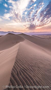
Mesquite Dunes sunrise, dawn, clouds and morning sky, sand dunes.
Location: Stovepipe Wells, Death Valley National Park, California
Image ID: 28688
Location: Stovepipe Wells, Death Valley National Park, California
Image ID: 28688
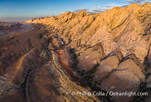
Aerial photo of the San Rafael Reef at dawn. A fold in the Earth's crust leads to this inclined section of the San Rafael Reef, at the eastern edge of the San Rafael Swell. Clearly seen are the characteristic triangular flatiron erosion patterns that typical this formation. The colors seen here arise primarily from Navajo and Wingate sandstone.
Location: Utah
Image ID: 39784
Location: Utah
Image ID: 39784
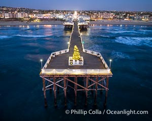
Aerial photo of Crystal Pier with Holiday Christmas Lights at night. The Crystal Pier, Holiday Lights and Pacific Ocean at sunset, waves blur as they crash upon the sand. Crystal Pier, 872 feet long and built in 1925, extends out into the Pacific Ocean from the town of Pacific Beach.
Location: Pacific Beach, California
Image ID: 40000
Location: Pacific Beach, California
Image ID: 40000
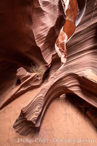
Rattlesnake Canyon, a beautiful slot canyon that is part of the larger Antelope Canyon system. Page, Arizona.
Location: Navajo Tribal Lands, Page, Arizona
Image ID: 36039
Location: Navajo Tribal Lands, Page, Arizona
Image ID: 36039
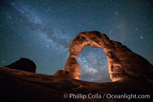
Milky Way and Stars over Delicate Arch, at night, Arches National Park, Utah.
Location: Delicate Arch, Arches National Park, Utah
Image ID: 29294
Location: Delicate Arch, Arches National Park, Utah
Image ID: 29294
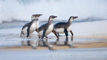
Magellanic penguins, coming ashore on a sandy beach. Magellanic penguins can grow to 30" tall, 14 lbs and live over 25 years. They feed in the water, preying on cuttlefish, sardines, squid, krill, and other crustaceans.
Species: Magellanic penguin, Spheniscus magellanicus
Location: New Island, Falkland Islands, United Kingdom
Image ID: 23924
Species: Magellanic penguin, Spheniscus magellanicus
Location: New Island, Falkland Islands, United Kingdom
Image ID: 23924
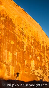
Rising sun creates the photographers shadow on a sandstone wall.
Location: Valley of Fire State Park, Nevada
Image ID: 26474
Location: Valley of Fire State Park, Nevada
Image ID: 26474
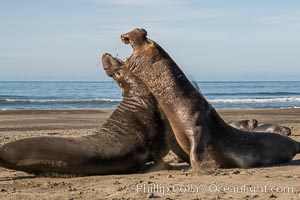
Male elephant seals (bulls) rear up on their foreflippers and fight for territory and harems of females. Bull elephant seals will haul out and fight from December through March, nearly fasting the entire time as they maintain their territory and harem. They bite and tear at each other on the neck and shoulders, drawing blood and creating scars on the tough hides. Sandy beach rookery, winter, Central California.
Species: Elephant seal, Mirounga angustirostris
Location: Piedras Blancas, San Simeon, California
Image ID: 35144
Species: Elephant seal, Mirounga angustirostris
Location: Piedras Blancas, San Simeon, California
Image ID: 35144
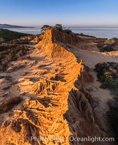
Sunrise over Broken Hill, overlooking La Jolla and the Pacific Ocean, Torrey Pines State Reserve.
Location: Torrey Pines State Reserve, San Diego, California
Image ID: 35844
Location: Torrey Pines State Reserve, San Diego, California
Image ID: 35844
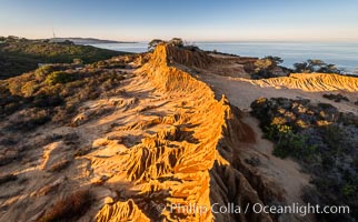
Sunrise over Broken Hill, overlooking La Jolla and the Pacific Ocean, Torrey Pines State Reserve.
Location: Torrey Pines State Reserve, San Diego, California
Image ID: 35845
Location: Torrey Pines State Reserve, San Diego, California
Image ID: 35845
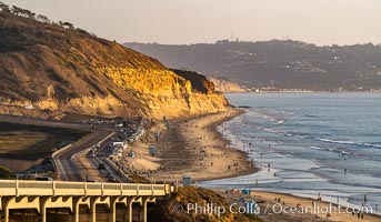
Torrey Pines State Beach at Sunset, La Jolla, Mount Soledad and Blacks Beach in the distance.
Location: Torrey Pines State Reserve, San Diego, California
Image ID: 35846
Location: Torrey Pines State Reserve, San Diego, California
Image ID: 35846
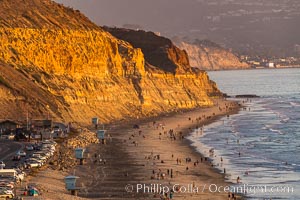
Torrey Pines State Beach at Sunset, La Jolla, Mount Soledad and Blacks Beach in the distance.
Location: Torrey Pines State Reserve, San Diego, California
Image ID: 35848
Location: Torrey Pines State Reserve, San Diego, California
Image ID: 35848
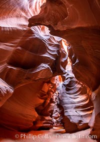
Upper Antelope Canyon, a deep, narrow and spectacular slot canyon lying on Navajo Tribal lands near Page, Arizona.
Location: Navajo Tribal Lands, Page, Arizona
Image ID: 35931
Location: Navajo Tribal Lands, Page, Arizona
Image ID: 35931