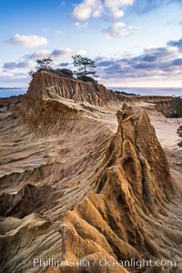
Torrey Pines storm clouds at sunset.
Location: Torrey Pines State Reserve, San Diego, California
Image ID: 29164
Location: Torrey Pines State Reserve, San Diego, California
Image ID: 29164
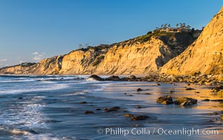
Black's Beach sea cliffs, sunset, looking north from Scripps Pier with Torrey Pines State Reserve in the distance.
Location: La Jolla, California
Image ID: 29165
Location: La Jolla, California
Image ID: 29165
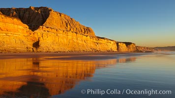
Torrey Pines State Beach, sandstone cliffs rise above the beach at Torrey Pines State Reserve.
Location: Torrey Pines State Reserve, San Diego, California
Image ID: 22435
Location: Torrey Pines State Reserve, San Diego, California
Image ID: 22435
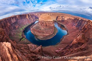
Horseshoe Bend. The Colorado River makes a 180-degree turn at Horseshoe Bend. Here the river has eroded the Navajo sandstone for eons, digging a canyon 1100-feet deep.
Location: Horseshoe Bend, Page, Arizona
Image ID: 26602
Location: Horseshoe Bend, Page, Arizona
Image ID: 26602
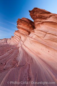
The Great Wall, Navajo Tribal Lands, Arizona. Sandstone "fins", eroded striations that depict how sandstone -- ancient compressed sand -- was laid down in layers over time. Now exposed, the layer erode at different rates, forming delicate "fins" that stretch for long distances.
Location: Navajo Tribal Lands, Page, Arizona
Image ID: 26643
Location: Navajo Tribal Lands, Page, Arizona
Image ID: 26643

Brown pelican portrait, resting on sandstone cliffs beside the sea, winter mating plumage with distinctive dark brown nape and red gular throat pouch.
Species: Brown Pelican, Pelecanus occidentalis, Pelecanus occidentalis californicus
Location: La Jolla, California
Image ID: 20157
Species: Brown Pelican, Pelecanus occidentalis, Pelecanus occidentalis californicus
Location: La Jolla, California
Image ID: 20157
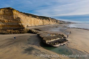
Torrey Pines balloon aerial survey photo. Torrey Pines seacliffs, rising up to 300 feet above the ocean, stretch from Del Mar to La Jolla. On the mesa atop the bluffs are found Torrey pine trees, one of the rare species of pines in the world. Peregrine falcons nest at the edge of the cliffs. This photo was made as part of an experimental balloon aerial photographic survey flight over Torrey Pines State Reserve, by permission of Torrey Pines State Reserve.
Location: Torrey Pines State Reserve, San Diego, California
Image ID: 27288
Location: Torrey Pines State Reserve, San Diego, California
Image ID: 27288
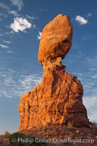
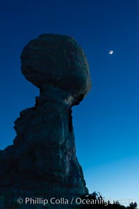
Balanced Rock, a narrow sandstone tower, appears poised to topple.
Location: Balanced Rock, Arches National Park, Utah
Image ID: 27839
Location: Balanced Rock, Arches National Park, Utah
Image ID: 27839
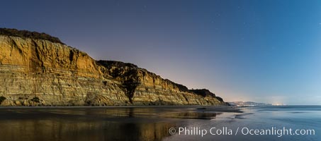
Torrey Pines Cliffs lit at night by a full moon, low tide reflections.
Location: Torrey Pines State Reserve, San Diego, California
Image ID: 28455
Panorama dimensions: 3623 x 8213
Location: Torrey Pines State Reserve, San Diego, California
Image ID: 28455
Panorama dimensions: 3623 x 8213
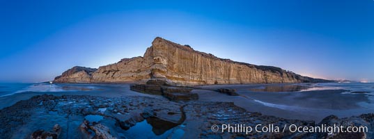
Torrey Pines Cliffs lit at night by a full moon, low tide reflections.
Location: Torrey Pines State Reserve, San Diego, California
Image ID: 28463
Panorama dimensions: 5072 x 13623
Location: Torrey Pines State Reserve, San Diego, California
Image ID: 28463
Panorama dimensions: 5072 x 13623
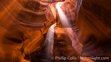
Light Beam in Upper Antelope Slot Canyon. Thin shafts of light briefly penetrate the convoluted narrows of Upper Antelope Slot Canyon, sending piercing beams through the sandstone maze to the sand floor below.
Location: Navajo Tribal Lands, Page, Arizona
Image ID: 28564
Location: Navajo Tribal Lands, Page, Arizona
Image ID: 28564
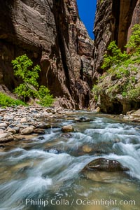
The Virgin River Narrows, where the Virgin River has carved deep, narrow canyons through the Zion National Park sandstone, creating one of the finest hikes in the world.
Location: Virgin River Narrows, Zion National Park, Utah
Image ID: 28585
Location: Virgin River Narrows, Zion National Park, Utah
Image ID: 28585
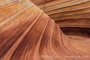
The Wave in the North Coyote Buttes, an area of fantastic eroded sandstone featuring beautiful swirls, wild colors, countless striations, and bizarre shapes set amidst the dramatic surrounding North Coyote Buttes of Arizona and Utah. The sandstone formations of the North Coyote Buttes, including the Wave, date from the Jurassic period. Managed by the Bureau of Land Management, the Wave is located in the Paria Canyon-Vermilion Cliffs Wilderness and is accessible on foot by permit only.
Location: North Coyote Buttes, Paria Canyon-Vermilion Cliffs Wilderness, Arizona
Image ID: 28602
Location: North Coyote Buttes, Paria Canyon-Vermilion Cliffs Wilderness, Arizona
Image ID: 28602
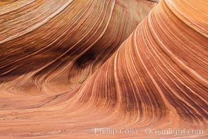
The Wave in the North Coyote Buttes, an area of fantastic eroded sandstone featuring beautiful swirls, wild colors, countless striations, and bizarre shapes set amidst the dramatic surrounding North Coyote Buttes of Arizona and Utah. The sandstone formations of the North Coyote Buttes, including the Wave, date from the Jurassic period. Managed by the Bureau of Land Management, the Wave is located in the Paria Canyon-Vermilion Cliffs Wilderness and is accessible on foot by permit only.
Location: North Coyote Buttes, Paria Canyon-Vermilion Cliffs Wilderness, Arizona
Image ID: 28603
Location: North Coyote Buttes, Paria Canyon-Vermilion Cliffs Wilderness, Arizona
Image ID: 28603
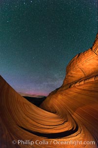
The Wave at Night, under a clear night sky full of stars. The Wave, an area of fantastic eroded sandstone featuring beautiful swirls, wild colors, countless striations, and bizarre shapes set amidst the dramatic surrounding North Coyote Buttes of Arizona and Utah. The sandstone formations of the North Coyote Buttes, including the Wave, date from the Jurassic period. Managed by the Bureau of Land Management, the Wave is located in the Paria Canyon-Vermilion Cliffs Wilderness and is accessible on foot by permit only.
Location: North Coyote Buttes, Paria Canyon-Vermilion Cliffs Wilderness, Arizona
Image ID: 28623
Location: North Coyote Buttes, Paria Canyon-Vermilion Cliffs Wilderness, Arizona
Image ID: 28623
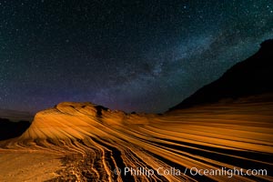
The Second Wave at Night. The Second Wave, a spectacular sandstone formation in the North Coyote Buttes, lies under a sky full of stars.
Location: North Coyote Buttes, Paria Canyon-Vermilion Cliffs Wilderness, Arizona
Image ID: 28628
Location: North Coyote Buttes, Paria Canyon-Vermilion Cliffs Wilderness, Arizona
Image ID: 28628
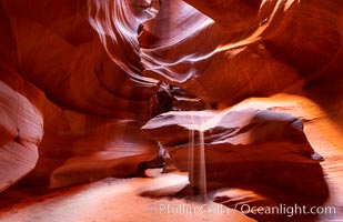
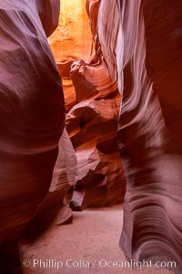
Upper Antelope Canyon, a deep, narrow and spectacular slot canyon lying on Navajo Tribal lands near Page, Arizona.
Location: Navajo Tribal Lands, Page, Arizona
Image ID: 35934
Location: Navajo Tribal Lands, Page, Arizona
Image ID: 35934
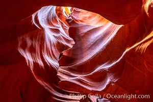
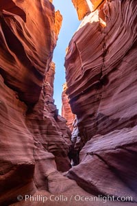
Upper Antelope Canyon, a deep, narrow and spectacular slot canyon lying on Navajo Tribal lands near Page, Arizona.
Location: Navajo Tribal Lands, Page, Arizona
Image ID: 35935
Location: Navajo Tribal Lands, Page, Arizona
Image ID: 35935
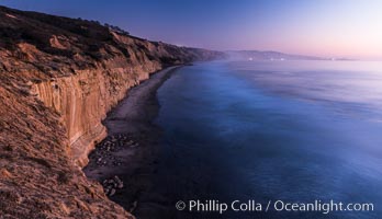
Seacliffs, La Jolla and evening lights, dusk, Pacific Ocean surf.
Location: La Jolla, California
Image ID: 28988
Location: La Jolla, California
Image ID: 28988
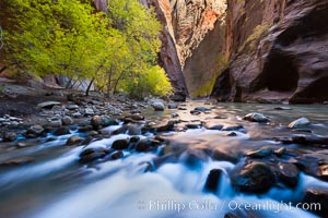
Yellow cottonwood trees in autumn, fall colors in the Virgin River Narrows in Zion National Park.
Location: Virgin River Narrows, Zion National Park, Utah
Image ID: 26089
Location: Virgin River Narrows, Zion National Park, Utah
Image ID: 26089
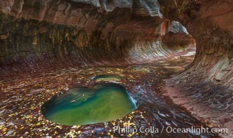
The Subway, a iconic eroded sandstone formation in Zion National Park.
Location: The Subway, Zion National Park, Utah
Image ID: 26093
Location: The Subway, Zion National Park, Utah
Image ID: 26093
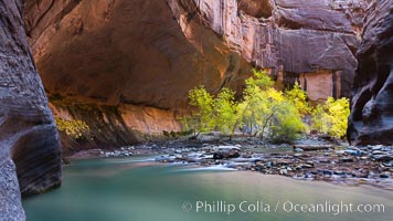
Flowing water and fall cottonwood trees, along the Virgin River in the Zion Narrows in autumn.
Location: Virgin River Narrows, Zion National Park, Utah
Image ID: 26105
Location: Virgin River Narrows, Zion National Park, Utah
Image ID: 26105
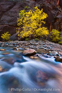
Flowing water and fall cottonwood trees, along the Virgin River in the Zion Narrows in autumn.
Location: Virgin River Narrows, Zion National Park, Utah
Image ID: 26107
Location: Virgin River Narrows, Zion National Park, Utah
Image ID: 26107
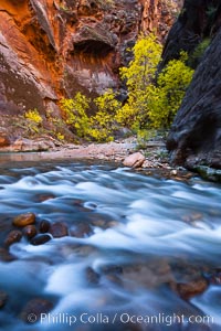
Virgin River narrows and fall colors, cottonwood trees in autumn along the Virgin River with towering sandstone cliffs.
Location: Virgin River Narrows, Zion National Park, Utah
Image ID: 26109
Location: Virgin River Narrows, Zion National Park, Utah
Image ID: 26109
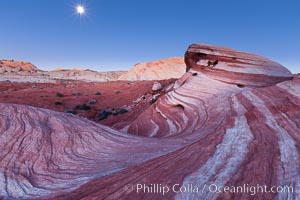
The moon sets over the Fire Wave, a beautiful sandstone formation exhibiting dramatic striations, striped layers in the geologic historical record.
Location: Valley of Fire State Park, Nevada
Image ID: 26511
Location: Valley of Fire State Park, Nevada
Image ID: 26511
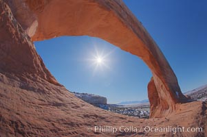
Wilson Arch rises high above route 191 in eastern Utah, with a span of 91 feet and a height of 46 feet.
Location: Wilson Arch, Utah
Image ID: 18031
Location: Wilson Arch, Utah
Image ID: 18031
