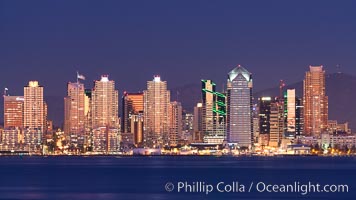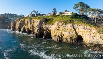
La Jolla Caves and the Coast Walk, La Jolla. Aerial panoramic photograph.
Location: La Jolla, California
Image ID: 37953
Location: La Jolla, California
Image ID: 37953
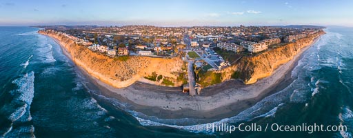
Fletcher Cove and Solana Beach Aerial Photo, aerial panorama of Pillbox and Solana Beach coastline.
Location: Solana Beach, California
Image ID: 37965
Panorama dimensions: 5454 x 13953
Location: Solana Beach, California
Image ID: 37965
Panorama dimensions: 5454 x 13953
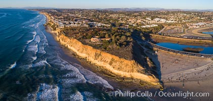
Solana Beach and Del Mar dog beach, aerial panoramic photo.
Location: Solana Beach, California
Image ID: 37968
Location: Solana Beach, California
Image ID: 37968
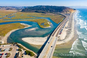
Los Penasquitos Lagoon and Torrey Pines State Beach, aerial photo.
Location: Del Mar, California
Image ID: 38007
Location: Del Mar, California
Image ID: 38007
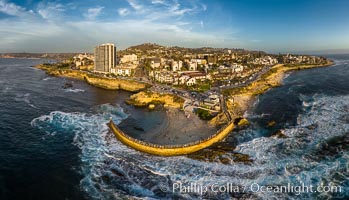
Childrens Pool seawall and Casa Cove aerial photo, La Jolla, California. Sunset. Aerial panoramic photograph.
Location: La Jolla, California
Image ID: 38037
Panorama dimensions: 5602 x 9774
Location: La Jolla, California
Image ID: 38037
Panorama dimensions: 5602 x 9774
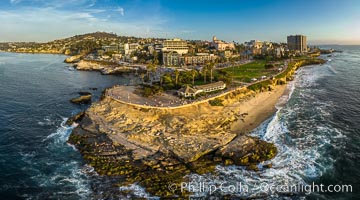
Point La Jolla and Scripps Park aerial photo, sunset, sea lions and sea gulls and tourists looking down on Boomer Beach. Aerial panoramic photo.
Location: La Jolla, California
Image ID: 38073
Panorama dimensions: 5257 x 9461
Location: La Jolla, California
Image ID: 38073
Panorama dimensions: 5257 x 9461
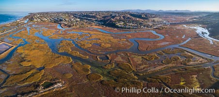
San Elijo Lagoon aerial photo, panorama.
Location: Encinitas, California
Image ID: 38138
Panorama dimensions: 3867 x 8738
Location: Encinitas, California
Image ID: 38138
Panorama dimensions: 3867 x 8738
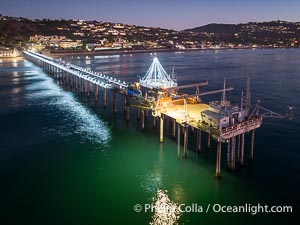
Holiday Christmas Lights on Scripps Pier, Scripps Institution of Oceanography, sunset, aerial.
Location: La Jolla, California
Image ID: 39880
Location: La Jolla, California
Image ID: 39880
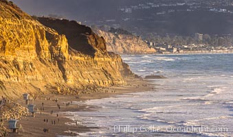
Torrey Pines State Beach at Sunset, La Jolla, Mount Soledad and Blacks Beach in the distance.
Location: Torrey Pines State Reserve, San Diego, California
Image ID: 36741
Location: Torrey Pines State Reserve, San Diego, California
Image ID: 36741
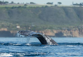
Gray whale raising fluke before diving, on southern migration to calving lagoons in Baja.
Species: Gray whale, Eschrichtius robustus
Location: San Diego, California
Image ID: 30464
Species: Gray whale, Eschrichtius robustus
Location: San Diego, California
Image ID: 30464
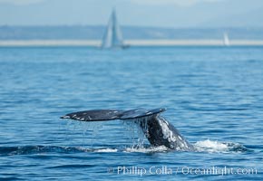
Gray whale raising fluke before diving, on southern migration to calving lagoons in Baja.
Species: Gray whale, Eschrichtius robustus
Location: San Diego, California
Image ID: 30467
Species: Gray whale, Eschrichtius robustus
Location: San Diego, California
Image ID: 30467
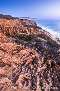
Torrey Pines Cliffs and Pacific Ocean, Razor Point view to La Jolla, San Diego, California.
Location: Torrey Pines State Reserve, San Diego, California
Image ID: 28485
Location: Torrey Pines State Reserve, San Diego, California
Image ID: 28485
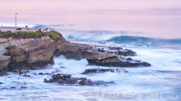
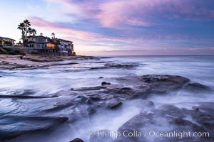
La Jolla Cove and Point La Jolla at Dawn, waves blur into abstract white, pre-sunrise soft light.
Location: La Jolla, California
Image ID: 38915
Location: La Jolla, California
Image ID: 38915
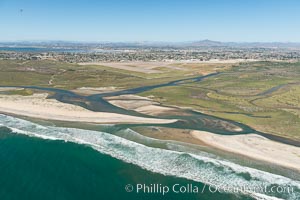
Aerial Photo of Tijuana River Mouth SMCA. Tijuana River Mouth State Marine Conservation Area borders Imperial Beach and the Mexican Border.
Location: Imperial Beach, California
Image ID: 30648
Location: Imperial Beach, California
Image ID: 30648
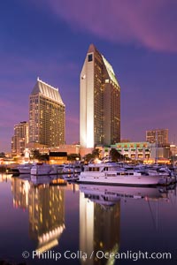
Manchester Grand Hyatt Hotel at sunset, viewed from the San Diego Embarcadero Marine Park.
Location: San Diego, California
Image ID: 26560
Location: San Diego, California
Image ID: 26560
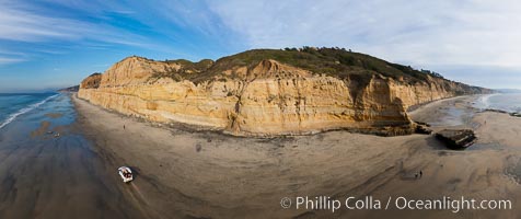
Torrey Pines balloon aerial survey photo. Torrey Pines seacliffs, rising up to 300 feet above the ocean, stretch from Del Mar to La Jolla. On the mesa atop the bluffs are found Torrey pine trees, one of the rare species of pines in the world. Peregrine falcons nest at the edge of the cliffs. This photo was made as part of an experimental balloon aerial photographic survey flight over Torrey Pines State Reserve, by permission of Torrey Pines State Reserve.
Location: Torrey Pines State Reserve, San Diego, California
Image ID: 27271
Panorama dimensions: 5001 x 11896
Location: Torrey Pines State Reserve, San Diego, California
Image ID: 27271
Panorama dimensions: 5001 x 11896

Nuclear submarine at the surface of the ocean, aerial photo.
Location: San Diego, California
Image ID: 29069
Location: San Diego, California
Image ID: 29069
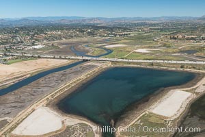
Aerial photo of San Dieguito Lagoon State Marine Conservation Area. San Dieguito Lagoon State Marine Conservation Area (SMCA) is a marine protected area near Del Mar in San Diego County.
Location: Del Mar, California
Image ID: 30607
Location: Del Mar, California
Image ID: 30607
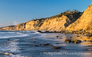
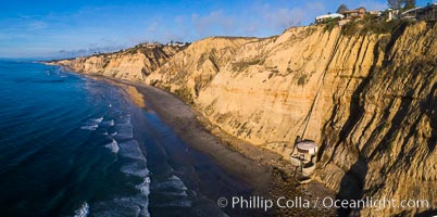
Black's Beach sea cliffs, sunset, looking north from Scripps Pier with Torrey Pines State Reserve in the distance.
Location: La Jolla, California
Image ID: 29165
Location: La Jolla, California
Image ID: 29165
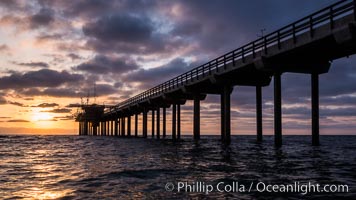
Scripps Pier, Surfer's view from among the waves. Research pier at Scripps Institution of Oceanography SIO, sunset.
Location: Scripps Institution of Oceanography, La Jolla, California
Image ID: 30147
Location: Scripps Institution of Oceanography, La Jolla, California
Image ID: 30147

California Brown Pelican flying over sea foam and waves.
Species: Brown Pelican, Pelecanus occidentalis, Pelecanus occidentalis californicus
Location: La Jolla, California
Image ID: 30367
Species: Brown Pelican, Pelecanus occidentalis, Pelecanus occidentalis californicus
Location: La Jolla, California
Image ID: 30367
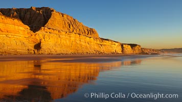
Torrey Pines State Beach, sandstone cliffs rise above the beach at Torrey Pines State Reserve.
Location: Torrey Pines State Reserve, San Diego, California
Image ID: 22435
Location: Torrey Pines State Reserve, San Diego, California
Image ID: 22435
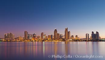
San Diego downtown city skyline and waterfront, sunrise, dawn, viewed from Coronado Island.
Location: San Diego, California
Image ID: 27090
Location: San Diego, California
Image ID: 27090
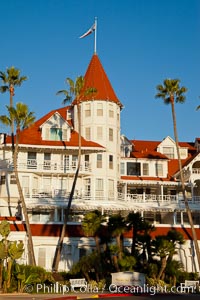
Hotel del Coronado, known affectionately as the Hotel Del. It was once the largest hotel in the world, and is one of the few remaining wooden Victorian beach resorts. It sits on the beach on Coronado Island, seen here with downtown San Diego in the distance. It is widely considered to be one of Americas most beautiful and classic hotels. Built in 1888, it was designated a National Historic Landmark in 1977.
Location: San Diego, California
Image ID: 27106
Location: San Diego, California
Image ID: 27106
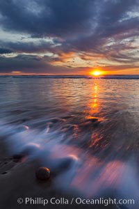
Surf and sky at sunset, waves crash upon the sand at dusk.
Location: Carlsbad, California
Image ID: 27234
Location: Carlsbad, California
Image ID: 27234
