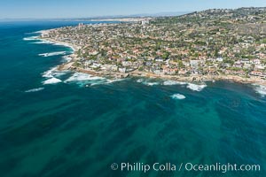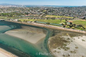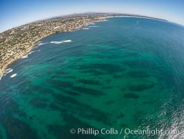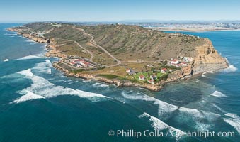
Aerial Photo of Cabrillo State Marine Reserve, Point Loma, San Diego.
Location: San Diego, California
Image ID: 30641
Location: San Diego, California
Image ID: 30641
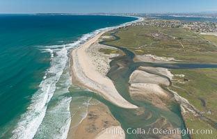
Aerial Photo of Tijuana River Mouth SMCA. Tijuana River Mouth State Marine Conservation Area borders Imperial Beach and the Mexican Border.
Location: Imperial Beach, California
Image ID: 30660
Location: Imperial Beach, California
Image ID: 30660
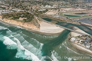
Aerial photo of San Dieguito Lagoon and Dog Beach. San Dieguito Lagoon State Marine Conservation Area (SMCA) is a marine protected area near Del Mar in San Diego County.
Location: Del Mar, California
Image ID: 30604
Location: Del Mar, California
Image ID: 30604
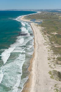
Aerial Photo of Tijuana River Mouth SMCA. Tijuana River Mouth State Marine Conservation Area borders Imperial Beach and the Mexican Border.
Location: Imperial Beach, California
Image ID: 30649
Location: Imperial Beach, California
Image ID: 30649
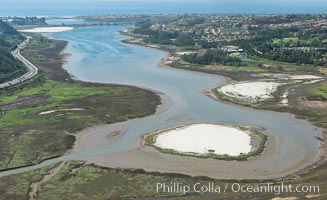
Aerial photo of Batiquitos Lagoon, Carlsbad. The Batiquitos Lagoon is a coastal wetland in southern Carlsbad, California. Part of the lagoon is designated as the Batiquitos Lagoon State Marine Conservation Area, run by the California Department of Fish and Game as a nature reserve.
Location: Carlsbad, Callifornia
Image ID: 30563
Location: Carlsbad, Callifornia
Image ID: 30563
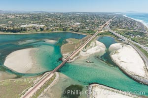
Aerial photo of Batiquitos Lagoon, Carlsbad. The Batiquitos Lagoon is a coastal wetland in southern Carlsbad, California. Part of the lagoon is designated as the Batiquitos Lagoon State Marine Conservation Area, run by the California Department of Fish and Game as a nature reserve.
Location: Carlsbad, Callifornia
Image ID: 30569
Location: Carlsbad, Callifornia
Image ID: 30569
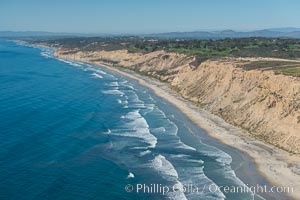
Aerial Photo of San Diego Scripps Coastal SMCA. Blacks Beach and Torrey Pines State Reserve.
Location: La Jolla, California
Image ID: 30622
Location: La Jolla, California
Image ID: 30622
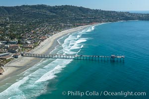
Aerial Photo of San Diego Scripps Coastal SMCA. Scripps Institution of Oceanography Research Pier.
Location: Scripps Institution of Oceanography, La Jolla, California
Image ID: 30626
Location: Scripps Institution of Oceanography, La Jolla, California
Image ID: 30626
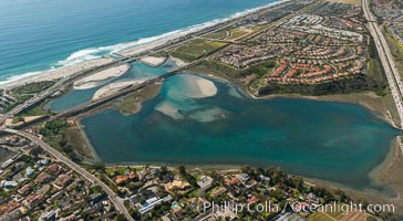
Aerial photo of Batiquitos Lagoon, Carlsbad. The Batiquitos Lagoon is a coastal wetland in southern Carlsbad, California. Part of the lagoon is designated as the Batiquitos Lagoon State Marine Conservation Area, run by the California Department of Fish and Game as a nature reserve.
Location: Carlsbad, Callifornia
Image ID: 30665
Location: Carlsbad, Callifornia
Image ID: 30665
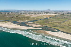
Aerial Photo of Tijuana River Mouth SMCA. Tijuana River Mouth State Marine Conservation Area borders Imperial Beach and the Mexican Border.
Location: Imperial Beach, California
Image ID: 30648
Location: Imperial Beach, California
Image ID: 30648
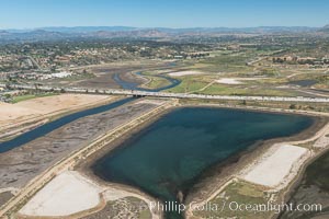
Aerial photo of San Dieguito Lagoon State Marine Conservation Area. San Dieguito Lagoon State Marine Conservation Area (SMCA) is a marine protected area near Del Mar in San Diego County.
Location: Del Mar, California
Image ID: 30607
Location: Del Mar, California
Image ID: 30607
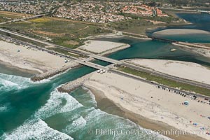
Aerial photo of Batiquitos Lagoon, Carlsbad. The Batiquitos Lagoon is a coastal wetland in southern Carlsbad, California. Part of the lagoon is designated as the Batiquitos Lagoon State Marine Conservation Area, run by the California Department of Fish and Game as a nature reserve.
Location: Carlsbad, Callifornia
Image ID: 30556
Location: Carlsbad, Callifornia
Image ID: 30556
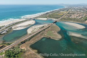
Aerial photo of Batiquitos Lagoon, Carlsbad. The Batiquitos Lagoon is a coastal wetland in southern Carlsbad, California. Part of the lagoon is designated as the Batiquitos Lagoon State Marine Conservation Area, run by the California Department of Fish and Game as a nature reserve.
Location: Carlsbad, Callifornia
Image ID: 30558
Location: Carlsbad, Callifornia
Image ID: 30558
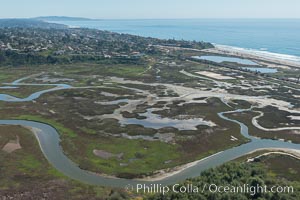
Aerial Photo of San Elijo Lagoon. San Elijo Lagoon Ecological Reserve is one of the largest remaining coastal wetlands in San Diego County, California, on the border of Encinitas, Solana Beach and Rancho Santa Fe.
Location: Encinitas, California
Image ID: 30592
Location: Encinitas, California
Image ID: 30592
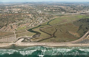
Aerial photo of Los Penasquitos Lagoon. Los Peñasquitos Marsh Natural Preserve and Lagoon is a coastal marsh in San Diego County, California, USA situated at the northern edge of the City of San Diego, forming the natural border with Del Mar, California.
Location: Del Mar, California
Image ID: 30602
Location: Del Mar, California
Image ID: 30602
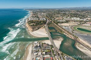
Aerial photo of San Dieguito Lagoon and Dog Beach. San Dieguito Lagoon State Marine Conservation Area (SMCA) is a marine protected area near Del Mar in San Diego County.
Location: Del Mar, California
Image ID: 30605
Location: Del Mar, California
Image ID: 30605
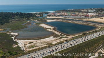
Aerial photo of San Dieguito Lagoon State Marine Conservation Area. San Dieguito Lagoon State Marine Conservation Area (SMCA) is a marine protected area near Del Mar in San Diego County.
Location: Del Mar, California
Image ID: 30609
Location: Del Mar, California
Image ID: 30609
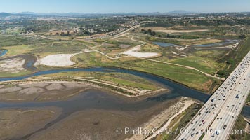
Aerial photo of San Dieguito Lagoon State Marine Conservation Area. San Dieguito Lagoon State Marine Conservation Area (SMCA) is a marine protected area near Del Mar in San Diego County.
Location: Del Mar, California
Image ID: 30614
Location: Del Mar, California
Image ID: 30614
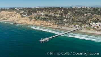
Aerial Photo of San Diego Scripps Coastal SMCA. Scripps Institution of Oceanography Research Pier.
Location: Scripps Institution of Oceanography, La Jolla, California
Image ID: 30627
Location: Scripps Institution of Oceanography, La Jolla, California
Image ID: 30627
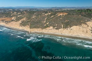
Torrey Pines seacliffs, rising up to 300 feet above the ocean, stretch from Del Mar to La Jolla. On the mesa atop the bluffs are found Torrey pine trees, one of the rare species of pines in the world.
Location: Torrey Pines State Reserve, San Diego, California
Image ID: 30673
Location: Torrey Pines State Reserve, San Diego, California
Image ID: 30673
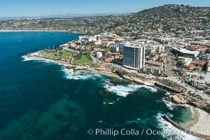
Aerial Photo of La Jolla coastline, showing underwater reefs and Mount Soledad.
Location: La Jolla, California
Image ID: 30676
Location: La Jolla, California
Image ID: 30676
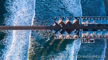
Aerial Photo of Crystal Pier, 872 feet long and built in 1925, extends out into the Pacific Ocean from the town of Pacific Beach.
Location: San Diego, California
Image ID: 38229
Location: San Diego, California
Image ID: 38229
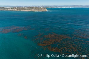
Aerial Photo of Kelp Forests at Cabrillo State Marine Reserve, Point Loma, San Diego.
Location: San Diego, California
Image ID: 30642
Location: San Diego, California
Image ID: 30642
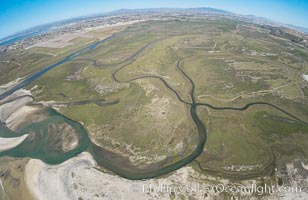
Aerial Photo of Tijuana River Mouth SMCA. Tijuana River Mouth State Marine Conservation Area borders Imperial Beach and the Mexican Border.
Location: Imperial Beach, California
Image ID: 30659
Location: Imperial Beach, California
Image ID: 30659
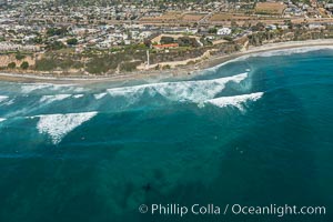
Aerial Photo of Swamis Marine Conservation Area. Swamis State Marine Conservation Area (SMCA) is a marine protected area that extends offshore of Encinitas in San Diego County.
Location: Encinitas, California
Image ID: 30574
Location: Encinitas, California
Image ID: 30574
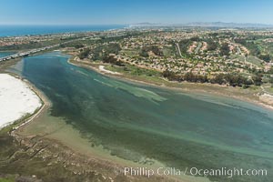
Aerial photo of Batiquitos Lagoon, Carlsbad. The Batiquitos Lagoon is a coastal wetland in southern Carlsbad, California. Part of the lagoon is designated as the Batiquitos Lagoon State Marine Conservation Area, run by the California Department of Fish and Game as a nature reserve.
Location: Carlsbad, Callifornia
Image ID: 30561
Location: Carlsbad, Callifornia
Image ID: 30561
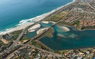
Aerial photo of Batiquitos Lagoon, Carlsbad. The Batiquitos Lagoon is a coastal wetland in southern Carlsbad, California. Part of the lagoon is designated as the Batiquitos Lagoon State Marine Conservation Area, run by the California Department of Fish and Game as a nature reserve.
Location: Carlsbad, Callifornia
Image ID: 30572
Location: Carlsbad, Callifornia
Image ID: 30572
