
Panoramic photo of Crater Lake National Park.
Location: Crater Lake National Park, Oregon
Image ID: 28675
Panorama dimensions: 3271 x 10669
Location: Crater Lake National Park, Oregon
Image ID: 28675
Panorama dimensions: 3271 x 10669
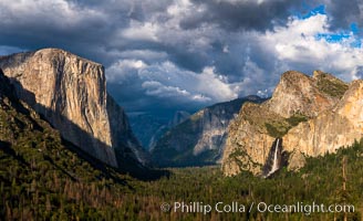
Yosemite Valley Tunnel View, Storm clouds at sunset, Yosemite National Park.
Location: Yosemite National Park, California
Image ID: 34542
Panorama dimensions: 7653 x 12541
Location: Yosemite National Park, California
Image ID: 34542
Panorama dimensions: 7653 x 12541

The Tree of Eons, a spectacular dendritic formation in the Bentonite Hills of Utah. Fantastic colorful sedimentary patterns, ancient Bentonite layers are exposed through erosion in the Utah Badlands. The Bentonite Hills are composed of the Brushy Basin shale member of the Morrison Formation. This layer was formed during Jurassic times when mud, silt, fine sand, and volcanic ash were deposited in swamps and lakes. Photographed just before sunrise with soft pre-dawn illumination. Aerial panoramic photograph.
Location: Utah
Image ID: 37951
Panorama dimensions: 11000 x 15000
Location: Utah
Image ID: 37951
Panorama dimensions: 11000 x 15000

Full Moon over San Diego City Skyline, viewed from Point Loma. Mount San Miguel is in center while Lyons Peak lies to the left.
Location: San Diego, California
Image ID: 29116
Panorama dimensions: 5261 x 18810
Location: San Diego, California
Image ID: 29116
Panorama dimensions: 5261 x 18810

San Diego Bay and Skyline at sunset, viewed from Point Loma, panoramic photograph.
Location: San Diego, California
Image ID: 30210
Location: San Diego, California
Image ID: 30210

San Diego city skyline at sunset, showing the buildings of downtown San Diego rising above San Diego Harbor, viewed from Harbor Island. A panoramic photograph, composite of thirteen separate images.
Location: San Diego, California
Image ID: 22255
Panorama dimensions: 4759 x 15430
Location: San Diego, California
Image ID: 22255
Panorama dimensions: 4759 x 15430
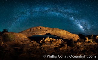
Panorama of the Milky Way over Mesa Arch.
Location: Mesa Arch, Canyonlands National Park, Utah
Image ID: 27824
Panorama dimensions: 4790 x 7815
Location: Mesa Arch, Canyonlands National Park, Utah
Image ID: 27824
Panorama dimensions: 4790 x 7815

San Diego city skyline at sunrise, showing the buildings of downtown San Diego rising above San Diego Harbor, viewed from Harbor Island.
Location: San Diego, California
Image ID: 27889
Panorama dimensions: 3497 x 12426
Location: San Diego, California
Image ID: 27889
Panorama dimensions: 3497 x 12426

Aerial View of Namena Marine Reserve and Coral Reefs, Namena Island, Fiji.
Location: Namena Marine Reserve, Namena Island, Fiji
Image ID: 34680
Panorama dimensions: 4800 x 16200
Location: Namena Marine Reserve, Namena Island, Fiji
Image ID: 34680
Panorama dimensions: 4800 x 16200

Ancient Douglas fir trees in Cathedral Grove. Cathedral Grove is home to huge, ancient, old-growth Douglas fir trees. About 300 years ago a fire killed most of the trees in this grove, but a small number of trees survived and were the originators of what is now Cathedral Grove. Western redcedar trees grow in adundance in the understory below the taller Douglas fir trees.
Species: Douglas fir tree, Pseudotsuga menziesii
Location: Cathedral Grove, MacMillan Provincial Park, Vancouver Island, British Columbia, Canada
Image ID: 22456
Panorama dimensions: 9702 x 3043
Species: Douglas fir tree, Pseudotsuga menziesii
Location: Cathedral Grove, MacMillan Provincial Park, Vancouver Island, British Columbia, Canada
Image ID: 22456
Panorama dimensions: 9702 x 3043
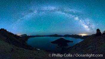
Milky Way and stars over Crater Lake at night. Panorama of Crater Lake and Wizard Island at night, Crater Lake National Park.
Location: Crater Lake National Park, Oregon
Image ID: 28641
Panorama dimensions: 7650 x 13389
Location: Crater Lake National Park, Oregon
Image ID: 28641
Panorama dimensions: 7650 x 13389
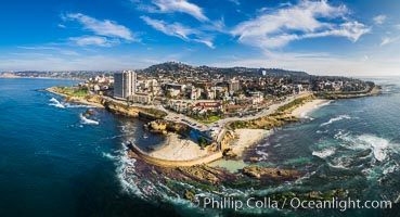
Childrens Pool Reef Exposed at Extreme Low Tide, La Jolla, California. Aerial panoramic photograph.
Location: La Jolla, California
Image ID: 37946
Panorama dimensions: 6176 x 11395
Location: La Jolla, California
Image ID: 37946
Panorama dimensions: 6176 x 11395

Full Moon Rises over the San Diego City Skyline and Mount Laguna, viewed from Point Loma, panoramic photograph.
Location: San Diego, California
Image ID: 36634
Panorama dimensions: 5276 x 16167
Location: San Diego, California
Image ID: 36634
Panorama dimensions: 5276 x 16167

San Diego Bay and Downtown City Skyline at Dawn, spectacular clouds light up over the city. Mount San Miguel in the distance.
Location: San Diego, California
Image ID: 37636
Panorama dimensions: 5305 x 14631
Location: San Diego, California
Image ID: 37636
Panorama dimensions: 5305 x 14631
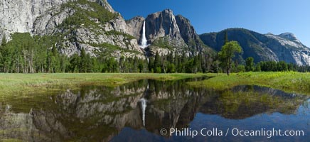
Yosemite Falls reflected in flooded meadow. The Merced River floods its banks in spring, forming beautiful reflections of Yosemite Falls.
Location: Yosemite National Park, California
Image ID: 26887
Panorama dimensions: 5256 x 11469
Location: Yosemite National Park, California
Image ID: 26887
Panorama dimensions: 5256 x 11469
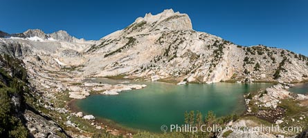
North Peak (12,242') rises over lower Conness Lake, its water colored deep blue-green by glacier runoff. Mount Conness (12,589') towers in the upper left. Hoover Wilderness, Inyo National Forest.
Location: Conness Lakes Basin, Hoover Wilderness, California
Image ID: 36427
Panorama dimensions: 7008 x 15585
Location: Conness Lakes Basin, Hoover Wilderness, California
Image ID: 36427
Panorama dimensions: 7008 x 15585
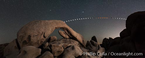
Lunar Eclipse and blood red moon sequence over Arch Rock, planet Mars above the moon, composite image, Joshua Tree National Park, April 14/15 2014.
Image ID: 29201
Panorama dimensions: 5835 x 14655
Image ID: 29201
Panorama dimensions: 5835 x 14655

Sunrise over the San Diego City Skyline.
Location: San Diego, California
Image ID: 28858
Panorama dimensions: 4522 x 18776
Location: San Diego, California
Image ID: 28858
Panorama dimensions: 4522 x 18776

Steller Sea Lions and Bald Eagles atop Norris Rocks, Hornby Island and Vancouver Island, panoramic photo.
Species: Steller sea lion, Eumetopias jubatus
Location: Hornby Island, British Columbia, Canada
Image ID: 32659
Panorama dimensions: 4637 x 24166
Species: Steller sea lion, Eumetopias jubatus
Location: Hornby Island, British Columbia, Canada
Image ID: 32659
Panorama dimensions: 4637 x 24166
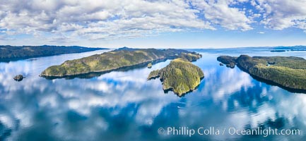
Browning Pass aerial photo, with Nigei Island (left) and Balackava Island (right).
Location: British Columbia, Canada
Image ID: 35252
Panorama dimensions: 6038 x 13074
Location: British Columbia, Canada
Image ID: 35252
Panorama dimensions: 6038 x 13074
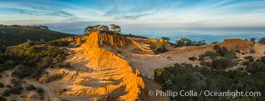
Broken Hill and view to La Jolla, panoramic photograph, from Torrey Pines State Reserve, sunrise.
Location: Torrey Pines State Reserve, San Diego, California
Image ID: 28397
Panorama dimensions: 4332 x 11344
Location: Torrey Pines State Reserve, San Diego, California
Image ID: 28397
Panorama dimensions: 4332 x 11344
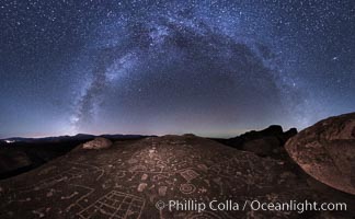
The Milky Way at Night over Sky Rock. Sky Rock petroglyphs near Bishop, California. Hidden atop an enormous boulder in the Volcanic Tablelands lies Sky Rock, a set of petroglyphs that face the sky. These superb examples of native American petroglyph artwork are thought to be Paiute in origin, but little is known about them.
Location: Bishop, California
Image ID: 28817
Panorama dimensions: 13870 x 16600
Location: Bishop, California
Image ID: 28817
Panorama dimensions: 13870 x 16600

Batiquitos Lagoon and Ponto, stormy sunset, aerial panoramic photograph.
Location: Carlsbad, California
Image ID: 37944
Panorama dimensions: 6058 x 15573
Location: Carlsbad, California
Image ID: 37944
Panorama dimensions: 6058 x 15573
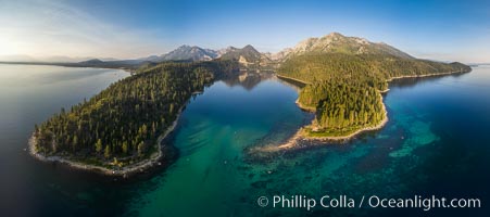
Emerald Bay Lake Tahoe, aerial panoramic photo of the mouth of the bay, early morning.
Location: Lake Tahoe, California
Image ID: 38130
Panorama dimensions: 4417 x 9952
Location: Lake Tahoe, California
Image ID: 38130
Panorama dimensions: 4417 x 9952
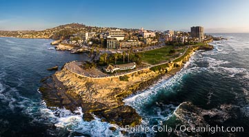
Aerial Panoramic Photo of Point La Jolla at sunset, La Jolla and Mount Soledad. People enjoying the sunset on the sea wall looking at sea lions on the rocks.
Location: La Jolla, California
Image ID: 38207
Panorama dimensions: 5354 x 9669
Location: La Jolla, California
Image ID: 38207
Panorama dimensions: 5354 x 9669
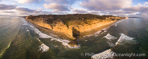
Flat Rock and Torrey Pines Seacliffs at Sunset, aerial photo.
Location: Torrey Pines State Reserve, San Diego, California
Image ID: 38227
Location: Torrey Pines State Reserve, San Diego, California
Image ID: 38227
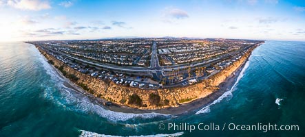
South Carlsbad State Beach and campground, aerial photo.
Location: Carlsbad, California
Image ID: 38228
Panorama dimensions: 4357 x 9642
Location: Carlsbad, California
Image ID: 38228
Panorama dimensions: 4357 x 9642
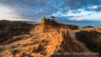
Clearing storm clouds over Broken Hill, overlooking La Jolla and the Pacific Ocean, Torrey Pines State Reserve.
Location: Torrey Pines State Reserve, San Diego, California
Image ID: 29416
Location: Torrey Pines State Reserve, San Diego, California
Image ID: 29416
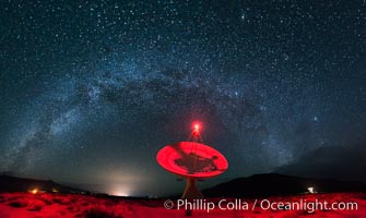
The OVRO 40 meter Telescope, part of the Owens Valley Radio Observatory located near Big Pine, California, USA. The telescope is used to conduct interferometric observations along with the other telescopes in the observatory, as a Very Long Baseline Interferometry (VLBI) station and as a single dish instrument. Its main focus today is on the monitoring of blazars.
Location: Big Pine, California
Image ID: 28796
Panorama dimensions: 7153 x 11978
Location: Big Pine, California
Image ID: 28796
Panorama dimensions: 7153 x 11978

San Diego Bay and Skyline, viewed from Point Loma, Mount San Miguel rising in the distance, panoramic photograph.
Location: San Diego, California
Image ID: 30203
Panorama dimensions: 4665 x 25269
Location: San Diego, California
Image ID: 30203
Panorama dimensions: 4665 x 25269