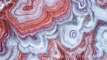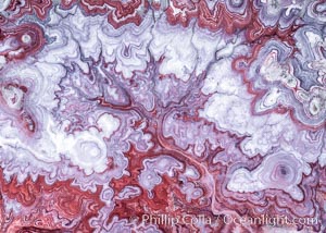
The Tree of Eons, a spectacular dendritic formation in the Bentonite Hills of Utah. Fantastic colorful sedimentary patterns, ancient Bentonite layers are exposed through erosion in the Utah Badlands. The Bentonite Hills are composed of the Brushy Basin shale member of the Morrison Formation. This layer was formed during Jurassic times when mud, silt, fine sand, and volcanic ash were deposited in swamps and lakes. Photographed just before sunrise with soft pre-dawn illumination. Aerial panoramic photograph.
Location: Utah
Image ID: 37951
Panorama dimensions: 11000 x 15000
Location: Utah
Image ID: 37951
Panorama dimensions: 11000 x 15000
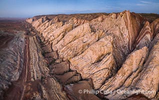
Aerial photo of the San Rafael Reef at dawn. A fold in the Earth's crust leads to this inclined section of the San Rafael Reef, at the eastern edge of the San Rafael Swell. Clearly seen are the characteristic triangular flatiron erosion patterns that typical this formation. The colors seen here arise primarily from Navajo and Wingate sandstone.
Location: Utah
Image ID: 39787
Location: Utah
Image ID: 39787
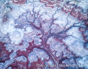
Pre-Dawn over the Tree of Eons, Utah. The Tree of Eons is a spectacular geologic sight near the San Rafael Swell. Erosion has cut a "tree" through red, blue, purple and white layers of the Chinle formation. The Tree of Eons is a superb example of dendritic erosion and to really appreciate the complex fractal-like details it must be observed from above. Photographed here in the soft, predawn light, it takes on magenta, red and purple hues just before the sun reaches it. Aerial panoramic photograph.
Location: Utah
Image ID: 38027
Location: Utah
Image ID: 38027
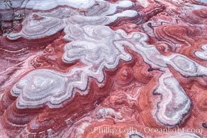
Fantastic colorful sedimentary patterns of Bentonite layers, seen as striations exposed in the Utah Badlands. The Bentonite Hills are composed of the Brushy Basin shale member of the Morrison Formation formed during Jurassic times when mud, silt, fine sand, and volcanic ash were deposited in swamps and lakes into layers, now revealed through erosion. Aerial photograph.
Location: Utah
Image ID: 37947
Location: Utah
Image ID: 37947
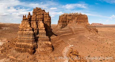
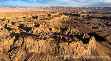
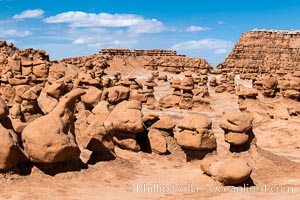
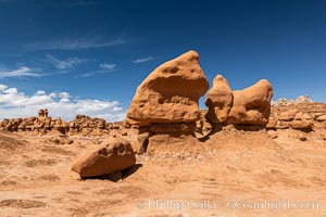
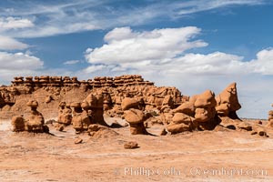
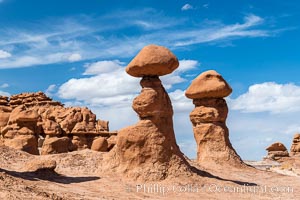
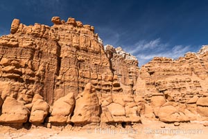
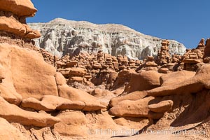
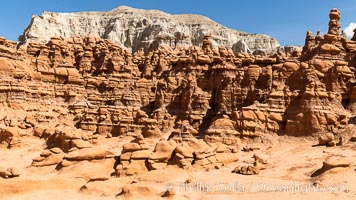
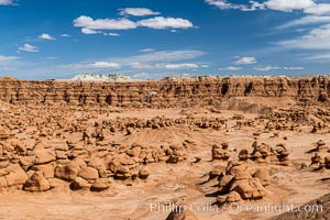
Molly's Castle, aerial view, Goblin Valley State Park. Curtis Formation whiteish caprock is on top, with reddish Entrada Sandstone below, both of Jurassic era. Molly's castle lies in the San Rafael desert near Goblin Valley, and drains into the Colorado River watershed. Aerial panoramic photograph.
Location: Goblin Valley State Park, Utah
Image ID: 37950
Location: Goblin Valley State Park, Utah
Image ID: 37950
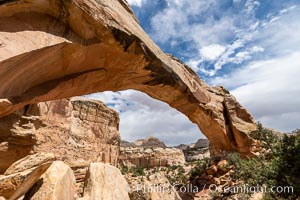
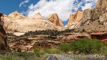
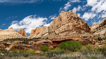
Hickman Bridge, Capitol Reef National Park.
Location: Capitol Reef National Park, Utah
Image ID: 37011
Location: Capitol Reef National Park, Utah
Image ID: 37011
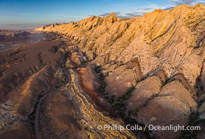
Aerial photo of the San Rafael Reef at dawn. A fold in the Earth's crust leads to this inclined section of the San Rafael Reef, at the eastern edge of the San Rafael Swell. Clearly seen are the characteristic triangular flatiron erosion patterns that typical this formation. The colors seen here arise primarily from Navajo and Wingate sandstone.
Location: Utah
Image ID: 39784
Location: Utah
Image ID: 39784
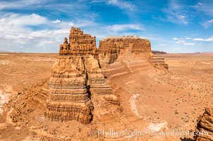
Molly's Castle, aerial view, Goblin Valley State Park.
Location: Mollys Castle, Goblin Valley State Park, Utah
Image ID: 38016
Location: Mollys Castle, Goblin Valley State Park, Utah
Image ID: 38016
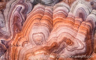
Fantastic colorful sedimentary patterns, Bentonite layers are seen as striations exposed in the Utah Badlands. The Bentonite Hills are composed of the Brushy Basin shale member of the Morrison Formation. This layer was formed during Jurassic times when mud, silt, fine sand, and volcanic ash were deposited in swamps and lakes. Aerial photograph.
Location: Utah
Image ID: 38029
Location: Utah
Image ID: 38029
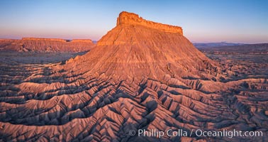
Factory Butte at sunrise. An exceptional example of a solitary butte surrounded by dramatically eroded badlands, Factory Butte stands alone on the San Rafael Swell.
Location: Factory Butte, Hanksville, Utah
Image ID: 38054
Location: Factory Butte, Hanksville, Utah
Image ID: 38054
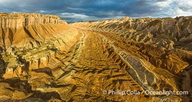
Aerial View of the San Rafael Reef, Utah. This is a canyon-like section of the San Rafael Reef, photographed at sunrise. The "reef proper" is on the right, with its characteristic triangular flatiron erosion. The canyon in the center is a fold in the Earth's crust affiliated with the boundary of the San Rafael Swell. The colors seen here arise primarily from Navajo and Wingate sandstone.
Location: Utah
Image ID: 39497
Panorama dimensions: 4490 x 8439
Location: Utah
Image ID: 39497
Panorama dimensions: 4490 x 8439
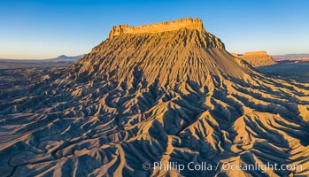
Factory Butte at sunrise, aerial photo, Utah. An exceptional example of solitary butte surrounded by dramatically eroded badlands, Factory Butte stands alone on the San Rafael Swell.
Location: Factory Butte, Hanksville, Utah
Image ID: 38076
Location: Factory Butte, Hanksville, Utah
Image ID: 38076
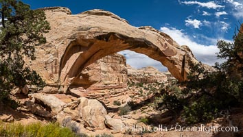
Hickman Bridge, Capitol Reef National Park.
Location: Capitol Reef National Park, Utah
Image ID: 37012
Panorama dimensions: 5985 x 11815
Location: Capitol Reef National Park, Utah
Image ID: 37012
Panorama dimensions: 5985 x 11815
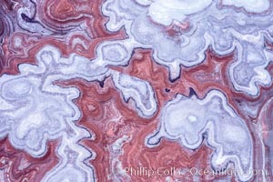
Fantastic colorful sedimentary patterns, Bentonite layers are seen as striations exposed in the Utah Badlands, part of the Brushy Basin shale member of the Morrison Formation. This layer was formed during Jurassic times when mud, silt, fine sand, and volcanic ash were deposited in swamps and lakes. Aerial photograph.
Location: Utah
Image ID: 38019
Location: Utah
Image ID: 38019
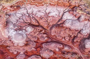
The Tree of Eons, Utah. The Tree of Eons is a spectacular geologic sight near the San Rafael Swell in Utah. Here the Tree of Eons is seen under the direct light of midday. Erosion has cut a dendritic "tree" through red, blue, purple and white layers of the Chinle formation. The Tree of Eons is a superb example of dendritic erosion and, to really appreciate its complex fractal-like details, must be observed from above.
Location: Utah
Image ID: 38201
Location: Utah
Image ID: 38201
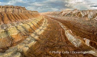
Aerial View of the San Rafael Reef, Utah. This is a canyon-like section of the San Rafael Reef, photographed at sunrise. The "reef proper" is on the right, with its characteristic triangular flatiron erosion. The canyon in the center is a fold in the Earth's crust affiliated with the boundary of the San Rafael Swell. The colors seen here arise primarily from Navajo and Wingate sandstone.
Location: Utah
Image ID: 39496
Location: Utah
Image ID: 39496
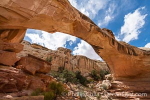
Hickman Bridge, Capitol Reef National Park. A natural bridge formed by water eroding it from below, Hickman Bridge is one of the most spectacular and easily accessible natural bridges in the United States.
Location: Capitol Reef National Park, Utah
Image ID: 37016
Location: Capitol Reef National Park, Utah
Image ID: 37016
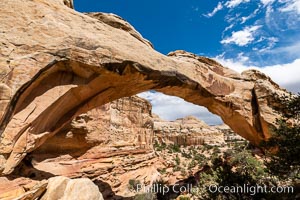
Hickman Bridge, Capitol Reef National Park.
Location: Capitol Reef National Park, Utah
Image ID: 37013
Location: Capitol Reef National Park, Utah
Image ID: 37013
