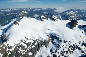
Mariner Mountain, on the west coast of Vancouver Island, British Columbia, Canada, part of Strathcona Provincial Park, located 36 km (22 mi) north of Tofino. It is 1,771 m (5,810 ft) high, snow covered year-round and home to several glaciers.
Location: Mariner Mountain, Strathcona Provincial Park, British Columbia, Canada
Image ID: 21072
Location: Mariner Mountain, Strathcona Provincial Park, British Columbia, Canada
Image ID: 21072
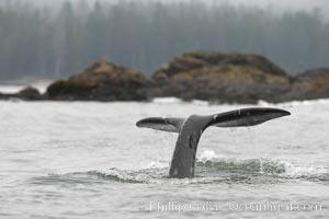
Gray whale, raising its fluke (tail) before diving to the ocean floor to forage for crustaceans, , Cow Bay, Flores Island, near Tofino, Clayoquot Sound, west coast of Vancouver Island.
Species: Gray whale, Eschrichtius robustus
Location: Cow Bay, Flores Island, British Columbia, Canada
Image ID: 21173
Species: Gray whale, Eschrichtius robustus
Location: Cow Bay, Flores Island, British Columbia, Canada
Image ID: 21173
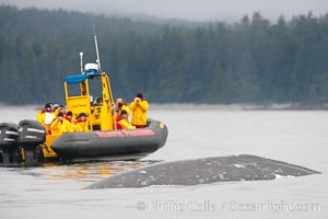
Gray whale dorsal ridge (back) at the surface in front of a boat full of whale watchers, Cow Bay, Flores Island, near Tofino, Clayoquot Sound, west coast of Vancouver Island.
Species: Gray whale, Eschrichtius robustus
Location: Cow Bay, Flores Island, British Columbia, Canada
Image ID: 21180
Species: Gray whale, Eschrichtius robustus
Location: Cow Bay, Flores Island, British Columbia, Canada
Image ID: 21180
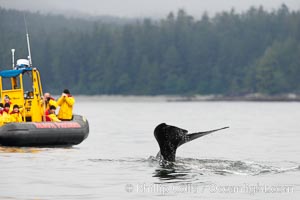
Gray whale raising its fluke (tail) in front of a boat of whale watchers before diving to the ocean floor to forage for crustaceans, Cow Bay, Flores Island, near Tofino, Clayoquot Sound, west coast of Vancouver Island.
Species: Gray whale, Eschrichtius robustus
Location: Cow Bay, Flores Island, British Columbia, Canada
Image ID: 21184
Species: Gray whale, Eschrichtius robustus
Location: Cow Bay, Flores Island, British Columbia, Canada
Image ID: 21184
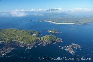
Blunden Island (foreground) and Vargas Island (distance), surrounded by the waters of Clayoquot Sound, west coast of Vancouver Island.
Location: Tofino, British Columbia, Canada
Image ID: 21069
Location: Tofino, British Columbia, Canada
Image ID: 21069

Panorama of the Big Tree Trail on Meares Island, temperate rainforest home to huge red cedar and spruce trees.
Location: Meares Island Big Trees Trail, Tofino, British Columbia, Canada
Image ID: 21062
Panorama dimensions: 12484 x 4051
Location: Meares Island Big Trees Trail, Tofino, British Columbia, Canada
Image ID: 21062
Panorama dimensions: 12484 x 4051
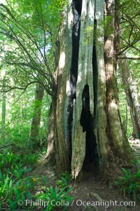
An enormous red cedar tree has been hit by lightning and burn through its core all the way to the ground, and still survives! The Big Tree Trail on Meares Island, temperate rainforest home to huge red cedar and spruce trees.
Location: Meares Island Big Trees Trail, Tofino, British Columbia, Canada
Image ID: 21063
Location: Meares Island Big Trees Trail, Tofino, British Columbia, Canada
Image ID: 21063
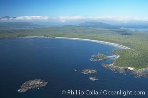
Ahouse Bay and Vargas Island, aerial photo, Clayoquot Sound in the foreground, near Tofino on the west coast of Vancouver Island.
Location: Tofino, British Columbia, Canada
Image ID: 21068
Location: Tofino, British Columbia, Canada
Image ID: 21068
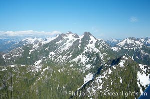
Mariner Mountain, viewed from the northwest, on the west coast of Vancouver Island, British Columbia, Canada, part of Strathcona Provincial Park, located 36 km (22 mi) north of Tofino. It is 1,771 m (5,810 ft) high, snow covered year-round and home to several glaciers.
Location: Mariner Mountain, Strathcona Provincial Park, British Columbia, Canada
Image ID: 21071
Location: Mariner Mountain, Strathcona Provincial Park, British Columbia, Canada
Image ID: 21071
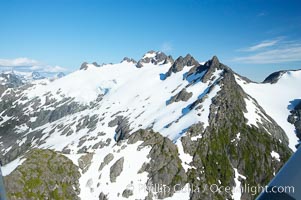
Mariner Mountain, viewed from the northwest, on the west coast of Vancouver Island, British Columbia, Canada, part of Strathcona Provincial Park, located 36 km (22 mi) north of Tofino. It is 1,771 m (5,810 ft) high, snow covered year-round and home to several glaciers.
Location: Mariner Mountain, Strathcona Provincial Park, British Columbia, Canada
Image ID: 21085
Location: Mariner Mountain, Strathcona Provincial Park, British Columbia, Canada
Image ID: 21085
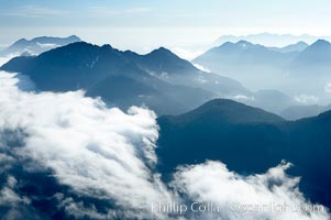
Coastal mountains and clouds, rising above Bedwell Sound (hidden by clouds) and Clayoquot Sound, near Tofino on the west coast of Vancouver Island.
Location: Tofino, British Columbia, Canada
Image ID: 21093
Location: Tofino, British Columbia, Canada
Image ID: 21093
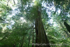
The Big Tree Trail on Meares Island, temperate rainforest home to huge red cedar and spruce trees.
Location: Meares Island Big Trees Trail, Tofino, British Columbia, Canada
Image ID: 21064
Location: Meares Island Big Trees Trail, Tofino, British Columbia, Canada
Image ID: 21064
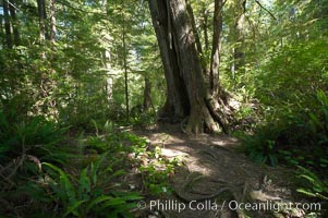
The Big Tree Trail on Meares Island, temperate rainforest home to huge red cedar and spruce trees.
Location: Meares Island Big Trees Trail, Tofino, British Columbia, Canada
Image ID: 21065
Location: Meares Island Big Trees Trail, Tofino, British Columbia, Canada
Image ID: 21065
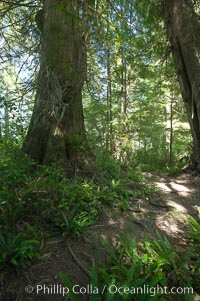
The Big Tree Trail on Meares Island, temperate rainforest home to huge red cedar and spruce trees.
Location: Meares Island Big Trees Trail, Tofino, British Columbia, Canada
Image ID: 21066
Location: Meares Island Big Trees Trail, Tofino, British Columbia, Canada
Image ID: 21066
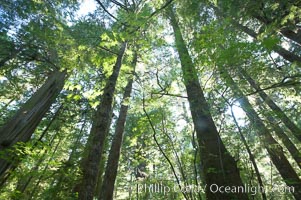
The Big Tree Trail on Meares Island, temperate rainforest home to huge red cedar and spruce trees.
Location: Meares Island Big Trees Trail, Tofino, British Columbia, Canada
Image ID: 21067
Location: Meares Island Big Trees Trail, Tofino, British Columbia, Canada
Image ID: 21067
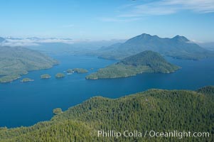
Flores Island (foreground) and Clayoquot Sound, aerial photo, near Tofino on the west coast of Vancouver Island.
Location: Tofino, British Columbia, Canada
Image ID: 21070
Location: Tofino, British Columbia, Canada
Image ID: 21070
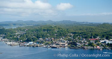
Tofino, a small beautiful town on the edge of Clayoquot Sound and the Pacific Ocean on the west coast of Vancouver Island, aerial photo.
Location: Tofino, British Columbia, Canada
Image ID: 21073
Location: Tofino, British Columbia, Canada
Image ID: 21073
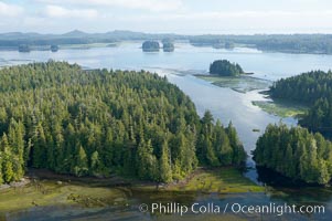
Lemmens Inlet viewed from Meares Island, with Tofino in the distance, aerial photo, on the west coast of Vancouver Island.
Location: Tofino, British Columbia, Canada
Image ID: 21074
Location: Tofino, British Columbia, Canada
Image ID: 21074
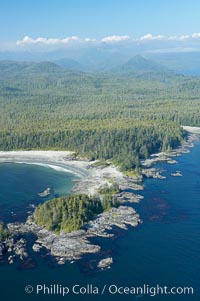
Cow Bay (left) and Flores Island, aerial photo, part of Clayoquot Sound, near Tofino on the west coast of Vancouver Island.
Location: Tofino, British Columbia, Canada
Image ID: 21075
Location: Tofino, British Columbia, Canada
Image ID: 21075
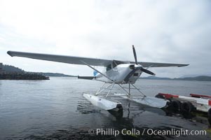
Seaplane at the floatplane dock in Tofino, typical overcast day.
Location: Tofino, British Columbia, Canada
Image ID: 21076
Location: Tofino, British Columbia, Canada
Image ID: 21076
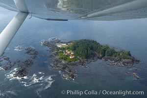
Lennard Island Lighthouse, aerial photo, surrounded by the waters of Clayoquot Sound near Tofino on the west coast of Vancouver Island, British Columbia, Canada.
Location: Tofino, British Columbia, Canada
Image ID: 21077
Location: Tofino, British Columbia, Canada
Image ID: 21077
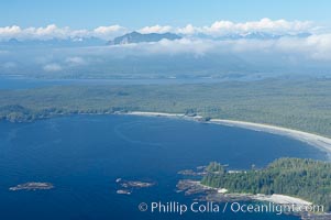
Ahouse Bay and Vargas Island, aerial photo, Clayoquot Sound in the foreground, near Tofino on the west coast of Vancouver Island.
Location: Tofino, British Columbia, Canada
Image ID: 21078
Location: Tofino, British Columbia, Canada
Image ID: 21078
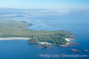
Ahouse Bay and Vargas Island, aerial photo, Clayoquot Sound in the foreground, near Tofino on the west coast of Vancouver Island.
Location: Tofino, British Columbia, Canada
Image ID: 21079
Location: Tofino, British Columbia, Canada
Image ID: 21079
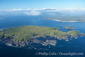
Blunden Island (foreground) and Vargas Island (distance), surrounded by the waters of Clayoquot Sound, west coast of Vancouver Island.
Location: Tofino, British Columbia, Canada
Image ID: 21080
Location: Tofino, British Columbia, Canada
Image ID: 21080
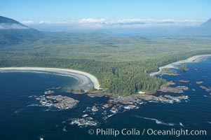
Cow Bay (left) and Flores Island, aerial photo, part of Clayoquot Sound, near Tofino on the west coast of Vancouver Island.
Location: Tofino, British Columbia, Canada
Image ID: 21081
Location: Tofino, British Columbia, Canada
Image ID: 21081
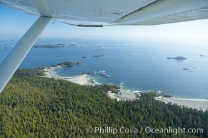
Cow Bay and Flores Island, aerial photo, part of Clayoquot Sound, near Tofino on the west coast of Vancouver Island.
Location: Tofino, British Columbia, Canada
Image ID: 21082
Location: Tofino, British Columbia, Canada
Image ID: 21082
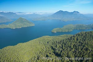
Flores Island (foreground) and Clayoquot Sound, aerial photo, near Tofino on the west coast of Vancouver Island.
Location: Tofino, British Columbia, Canada
Image ID: 21083
Location: Tofino, British Columbia, Canada
Image ID: 21083
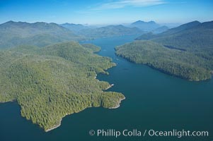
Obstruction Island (left) and Flores Island (right), Shelter Inlet section of Clayoquot Sound, aerial photo, near Tofino on the west coast of Vancouver Island.
Location: Tofino, British Columbia, Canada
Image ID: 21084
Location: Tofino, British Columbia, Canada
Image ID: 21084
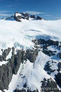
Glaciers on the summit of Mariner Mountain, on the west coast of Vancouver Island, British Columbia, Canada, part of Strathcona Provincial Park, located 36 km (22 mi) north of Tofino. It is 1,771 m (5,810 ft) high and is snow covered year-round.
Location: Mariner Mountain, Strathcona Provincial Park, British Columbia, Canada
Image ID: 21086
Location: Mariner Mountain, Strathcona Provincial Park, British Columbia, Canada
Image ID: 21086
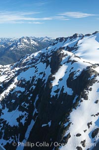
Mariner Mountain, viewed from the northeast, on the west coast of Vancouver Island, British Columbia, Canada, part of Strathcona Provincial Park, located 36 km (22 mi) north of Tofino. It is 1,771 m (5,810 ft) high, snow covered year-round and home to several glaciers.
Location: Mariner Mountain, Strathcona Provincial Park, British Columbia, Canada
Image ID: 21087
Location: Mariner Mountain, Strathcona Provincial Park, British Columbia, Canada
Image ID: 21087