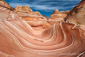
The Wave, an area of fantastic eroded sandstone featuring beautiful swirls, wild colors, countless striations, and bizarre shapes set amidst the dramatic surrounding North Coyote Buttes of Arizona and Utah. The sandstone formations of the North Coyote Buttes, including the Wave, date from the Jurassic period. Managed by the Bureau of Land Management, the Wave is located in the Paria Canyon-Vermilion Cliffs Wilderness and is accessible on foot by permit only.
Location: North Coyote Buttes, Paria Canyon-Vermilion Cliffs Wilderness, Arizona
Image ID: 20605
Location: North Coyote Buttes, Paria Canyon-Vermilion Cliffs Wilderness, Arizona
Image ID: 20605
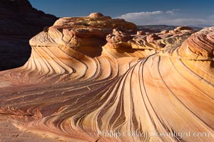
The Second Wave at Sunset, North Coyote Buttes. The Second Wave, a curiously-shaped sandstone swirl, takes on rich warm tones and dramatic shadowed textures at sunset. Set in the North Coyote Buttes of Arizona and Utah, the Second Wave is characterized by striations revealing layers of sedimentary deposits, a visible historical record depicting eons of submarine geology.
Location: North Coyote Buttes, Paria Canyon-Vermilion Cliffs Wilderness, Arizona
Image ID: 20606
Location: North Coyote Buttes, Paria Canyon-Vermilion Cliffs Wilderness, Arizona
Image ID: 20606
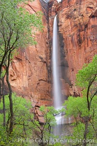
Waterfall at Temple of Sinawava during peak flow following spring rainstorm. Zion Canyon.
Location: Temple of Sinawava, Zion National Park, Utah
Image ID: 12450
Location: Temple of Sinawava, Zion National Park, Utah
Image ID: 12450
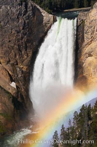
A rainbow appears in the mist of the Lower Falls of the Yellowstone River. At 308 feet, the Lower Falls of the Yellowstone River is the tallest fall in the park. This view is from Lookout Point on the North side of the Grand Canyon of the Yellowstone. When conditions are perfect in midsummer, a midmorning rainbow briefly appears in the falls.
Location: Grand Canyon of the Yellowstone, Yellowstone National Park, Wyoming
Image ID: 13319
Location: Grand Canyon of the Yellowstone, Yellowstone National Park, Wyoming
Image ID: 13319
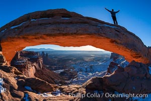
Extended High Mountain pose, Utthita Tadasana, sunrise on Mesa Arch, Utah. An exuberant hiker greets the dawning sun from atop Mesa Arch.
Location: Island in the Sky, Canyonlands National Park, Utah
Image ID: 18036
Location: Island in the Sky, Canyonlands National Park, Utah
Image ID: 18036
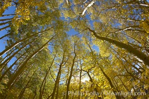
Aspen trees display Eastern Sierra fall colors, Lake Sabrina, Bishop Creek Canyon.
Species: Aspen, Populus tremuloides
Location: Bishop Creek Canyon, Sierra Nevada Mountains, California
Image ID: 17547
Species: Aspen, Populus tremuloides
Location: Bishop Creek Canyon, Sierra Nevada Mountains, California
Image ID: 17547
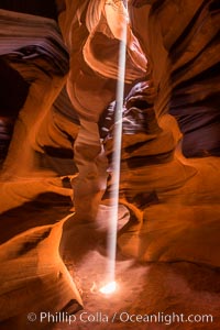
Light Beam in Upper Antelope Slot Canyon. Thin shafts of light briefly penetrate the convoluted narrows of Upper Antelope Slot Canyon, sending piercing beams through the sandstone maze to the sand floor below.
Location: Navajo Tribal Lands, Page, Arizona
Image ID: 28570
Location: Navajo Tribal Lands, Page, Arizona
Image ID: 28570
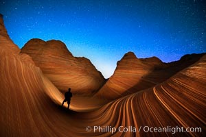
The Wave at Night, under a clear night sky full of stars. Photographer is illuminating the striated rocks with a small handheld light. The Wave, an area of fantastic eroded sandstone featuring beautiful swirls, wild colors, countless striations, and bizarre shapes is set amidst the dramatic surrounding North Coyote Buttes of Arizona and Utah. The sandstone formations of the North Coyote Buttes, including the Wave, date from the Jurassic period. Managed by the Bureau of Land Management, the Wave is located in the Paria Canyon-Vermilion Cliffs Wilderness and is accessible on foot by permit only.
Location: North Coyote Buttes, Paria Canyon-Vermilion Cliffs Wilderness, Arizona
Image ID: 28620
Location: North Coyote Buttes, Paria Canyon-Vermilion Cliffs Wilderness, Arizona
Image ID: 28620
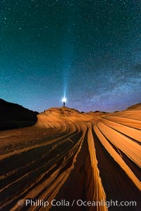
The Second Wave at Night. The Second Wave, a spectacular sandstone formation in the North Coyote Buttes, lies under a sky full of stars.
Location: North Coyote Buttes, Paria Canyon-Vermilion Cliffs Wilderness, Arizona
Image ID: 28627
Location: North Coyote Buttes, Paria Canyon-Vermilion Cliffs Wilderness, Arizona
Image ID: 28627
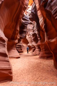
A hiker admiring the striated walls and dramatic light within Antelope Canyon, a deep narrow slot canyon formed by water and wind erosion.
Location: Navajo Tribal Lands, Page, Arizona
Image ID: 17993
Location: Navajo Tribal Lands, Page, Arizona
Image ID: 17993
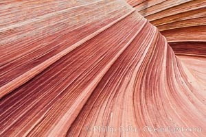
The Wave, an area of fantastic eroded sandstone featuring beautiful swirls, wild colors, countless striations, and bizarre shapes set amidst the dramatic surrounding North Coyote Buttes of Arizona and Utah. The sandstone formations of the North Coyote Buttes, including the Wave, date from the Jurassic period. Managed by the Bureau of Land Management, the Wave is located in the Paria Canyon-Vermilion Cliffs Wilderness and is accessible on foot by permit only.
Location: North Coyote Buttes, Paria Canyon-Vermilion Cliffs Wilderness, Arizona
Image ID: 20607
Location: North Coyote Buttes, Paria Canyon-Vermilion Cliffs Wilderness, Arizona
Image ID: 20607
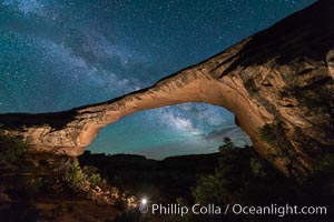
Owachomo Bridge and Milky Way. Owachomo Bridge, a natural stone bridge standing 106' high and spanning 130' wide,stretches across a canyon with the Milky Way crossing the night sky.
Location: Owachomo Bridge, Natural Bridges National Monument, Utah
Image ID: 28541
Location: Owachomo Bridge, Natural Bridges National Monument, Utah
Image ID: 28541
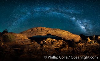
Panorama of the Milky Way over Mesa Arch.
Location: Mesa Arch, Canyonlands National Park, Utah
Image ID: 27824
Panorama dimensions: 4790 x 7815
Location: Mesa Arch, Canyonlands National Park, Utah
Image ID: 27824
Panorama dimensions: 4790 x 7815
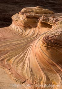
The Second Wave at Sunset, Vermillion Cliffs. The Second Wave, a curiously-shaped sandstone swirl, takes on rich warm tones and dramatic shadowed textures at sunset. Set in the North Coyote Buttes of Arizona and Utah, the Second Wave is characterized by striations revealing layers of sedimentary deposits, a visible historical record depicting eons of submarine geology.
Location: North Coyote Buttes, Paria Canyon-Vermilion Cliffs Wilderness, Arizona
Image ID: 28613
Location: North Coyote Buttes, Paria Canyon-Vermilion Cliffs Wilderness, Arizona
Image ID: 28613
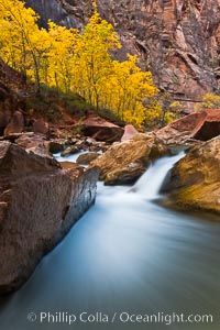
The Virgin River flows by autumn cottonwood trees, part of the Virgin River Narrows. This is a fantastic hike in fall with the comfortable temperatures, beautiful fall colors and light crowds.
Location: Virgin River Narrows, Zion National Park, Utah
Image ID: 26096
Location: Virgin River Narrows, Zion National Park, Utah
Image ID: 26096
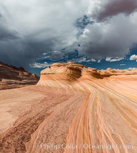
The Second Wave at sunset. The Second Wave, a curiously-shaped sandstone swirl, takes on rich warm tones and dramatic shadowed textures at sunset. Set in the North Coyote Buttes of Arizona and Utah, the Second Wave is characterized by striations revealing layers of sedimentary deposits, a visible historical record depicting eons of submarine geology.
Location: North Coyote Buttes, Paria Canyon-Vermilion Cliffs Wilderness, Arizona
Image ID: 28614
Location: North Coyote Buttes, Paria Canyon-Vermilion Cliffs Wilderness, Arizona
Image ID: 28614
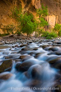
The Virgin River Narrows, where the Virgin River has carved deep, narrow canyons through the Zion National Park sandstone, creating one of the finest hikes in the world.
Location: Virgin River Narrows, Zion National Park, Utah
Image ID: 28575
Location: Virgin River Narrows, Zion National Park, Utah
Image ID: 28575
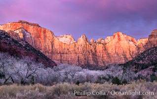
West Temple, The Sundial and the Altar of Sacrifice illuminated by soft alpenglow, about 20 minutes before sunrise.
Location: Zion National Park, Utah
Image ID: 37788
Location: Zion National Park, Utah
Image ID: 37788
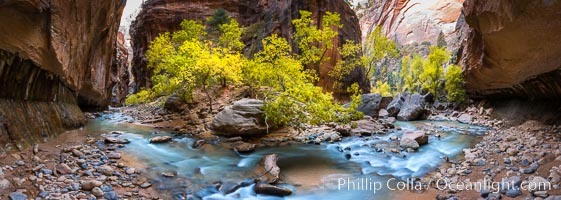
Fall Colors in the Virgin River Narrows, Zion National Park, Utah.
Location: Virgin River Narrows, Zion National Park, Utah
Image ID: 32634
Panorama dimensions: 5145 x 14424
Location: Virgin River Narrows, Zion National Park, Utah
Image ID: 32634
Panorama dimensions: 5145 x 14424
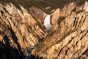
Lower Falls of the Yellowstone River. At 308 feet, the Lower Falls of the Yellowstone River is the tallest fall in the park. This view is from the famous and popular Artist Point on the south side of the Grand Canyon of the Yellowstone.
Location: Grand Canyon of the Yellowstone, Yellowstone National Park, Wyoming
Image ID: 07769
Location: Grand Canyon of the Yellowstone, Yellowstone National Park, Wyoming
Image ID: 07769
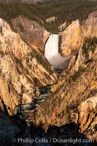
Lower Falls of the Yellowstone River. At 308 feet, the Lower Falls of the Yellowstone River is the tallest fall in the park. This view is from the famous and popular Artist Point on the south side of the Grand Canyon of the Yellowstone.
Location: Grand Canyon of the Yellowstone, Yellowstone National Park, Wyoming
Image ID: 07770
Location: Grand Canyon of the Yellowstone, Yellowstone National Park, Wyoming
Image ID: 07770
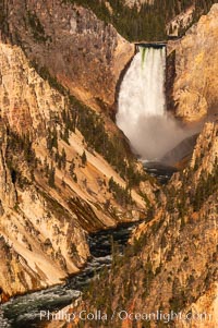
Lower Falls of the Yellowstone River. At 308 feet, the Lower Falls of the Yellowstone River is the tallest fall in the park. This view is from the famous and popular Artist Point on the south side of the Grand Canyon of the Yellowstone.
Location: Grand Canyon of the Yellowstone, Yellowstone National Park, Wyoming
Image ID: 07771
Location: Grand Canyon of the Yellowstone, Yellowstone National Park, Wyoming
Image ID: 07771
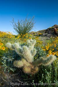
Cholla cactus, brittlebush, ocotillo and various cacti and wildflowers color the sides of Glorietta Canyon. Heavy winter rains led to a historic springtime bloom in 2005, carpeting the entire desert in vegetation and color for months.
Species: Encelia farinosa, Fouquieria splendens, Opuntia
Location: Anza-Borrego Desert State Park, Borrego Springs, California
Image ID: 10975
Species: Encelia farinosa, Fouquieria splendens, Opuntia
Location: Anza-Borrego Desert State Park, Borrego Springs, California
Image ID: 10975
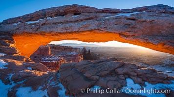
Mesa Arch spans 90 feet and stands at the edge of a mesa precipice thousands of feet above the Colorado River gorge. For a few moments at sunrise the underside of the arch glows dramatically red and orange.
Location: Island in the Sky, Canyonlands National Park, Utah
Image ID: 18040
Location: Island in the Sky, Canyonlands National Park, Utah
Image ID: 18040
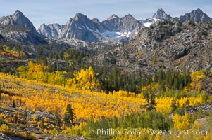
Aspen trees cover Bishop Creek Canyon above Aspendel.
Species: Aspen, Populus tremuloides
Location: Bishop Creek Canyon, Sierra Nevada Mountains, California
Image ID: 17528
Species: Aspen, Populus tremuloides
Location: Bishop Creek Canyon, Sierra Nevada Mountains, California
Image ID: 17528
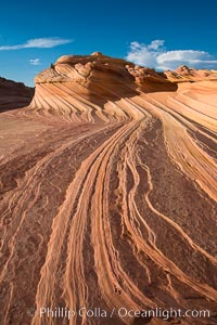
The Second Wave at Sunset, Vermillion Cliffs. The Second Wave, a curiously-shaped sandstone swirl, takes on rich warm tones and dramatic shadowed textures at sunset. Set in the North Coyote Buttes of Arizona and Utah, the Second Wave is characterized by striations revealing layers of sedimentary deposits, a visible historical record depicting eons of submarine geology.
Location: North Coyote Buttes, Paria Canyon-Vermilion Cliffs Wilderness, Arizona
Image ID: 28619
Location: North Coyote Buttes, Paria Canyon-Vermilion Cliffs Wilderness, Arizona
Image ID: 28619
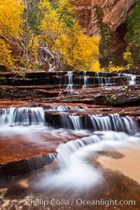
Archangel Falls in autumn, near the Subway in North Creek Canyon, with maples and cottonwoods turning fall colors.
Location: Zion National Park, Utah
Image ID: 26097
Location: Zion National Park, Utah
Image ID: 26097
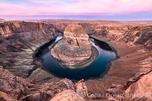
Spectacular Horseshoe Bend sunrise. The Colorado River makes a 180-degree turn at Horseshoe Bend. Here the river has eroded the Navajo sandstone for eons, digging a canyon 1100-feet deep.
Location: Horseshoe Bend, Page, Arizona
Image ID: 35939
Location: Horseshoe Bend, Page, Arizona
Image ID: 35939
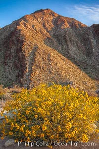
Brittlebush blooms in spring, Palm Canyon, Anza Borrego Desert State Park.
Species: Brittlebush, Encelia farinosa
Location: Anza-Borrego Desert State Park, Borrego Springs, California
Image ID: 24304
Species: Brittlebush, Encelia farinosa
Location: Anza-Borrego Desert State Park, Borrego Springs, California
Image ID: 24304

Sunset at Dead Horse Point Overlook, with the Colorado River flowing 2,000 feet below. 300 million years of erosion has carved the expansive canyons, cliffs and walls below and surrounding Deadhorse Point.
Location: Dead Horse Point State Park, Utah
Image ID: 27823
Panorama dimensions: 5303 x 17695
Location: Dead Horse Point State Park, Utah
Image ID: 27823
Panorama dimensions: 5303 x 17695