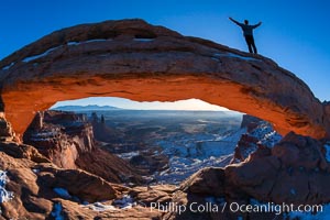
Extended High Mountain pose, Utthita Tadasana, sunrise on Mesa Arch, Utah. An exuberant hiker greets the dawning sun from atop Mesa Arch.
Location: Island in the Sky, Canyonlands National Park, Utah
Image ID: 18036
Location: Island in the Sky, Canyonlands National Park, Utah
Image ID: 18036
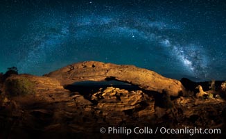
Panorama of the Milky Way over Mesa Arch.
Location: Mesa Arch, Canyonlands National Park, Utah
Image ID: 27824
Panorama dimensions: 4790 x 7815
Location: Mesa Arch, Canyonlands National Park, Utah
Image ID: 27824
Panorama dimensions: 4790 x 7815
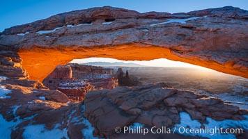
Mesa Arch spans 90 feet and stands at the edge of a mesa precipice thousands of feet above the Colorado River gorge. For a few moments at sunrise the underside of the arch glows dramatically red and orange.
Location: Island in the Sky, Canyonlands National Park, Utah
Image ID: 18040
Location: Island in the Sky, Canyonlands National Park, Utah
Image ID: 18040
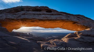
Mesa Arch Sunrise, Canyonlands National Park, Utah.
Location: Mesa Arch, Canyonlands National Park, Utah
Image ID: 29304
Location: Mesa Arch, Canyonlands National Park, Utah
Image ID: 29304
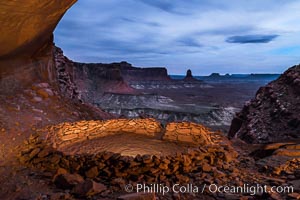
False Kiva at Sunset, Canyonlands National Park, Utah.
Location: Canyonlands National Park, Utah
Image ID: 29252
Location: Canyonlands National Park, Utah
Image ID: 29252
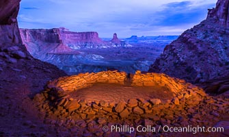
False Kiva at Sunset, Canyonlands National Park, Utah.
Location: False Kiva, Canyonlands National Park, Utah
Image ID: 28017
Location: False Kiva, Canyonlands National Park, Utah
Image ID: 28017
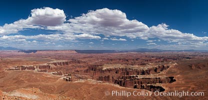
Canyonlands National Park panorama.
Location: Canyonlands National Park, Utah
Image ID: 27817
Panorama dimensions: 5316 x 11049
Location: Canyonlands National Park, Utah
Image ID: 27817
Panorama dimensions: 5316 x 11049
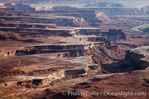
Soda Springs Basin from Green River Overlook, Island in the Sky, Canyonlands National Park, Utah.
Location: Canyonlands National Park, Utah
Image ID: 27841
Location: Canyonlands National Park, Utah
Image ID: 27841
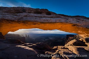
Mesa Arch Sunrise, Canyonlands National Park, Utah.
Location: Mesa Arch, Canyonlands National Park, Utah
Image ID: 29301
Location: Mesa Arch, Canyonlands National Park, Utah
Image ID: 29301
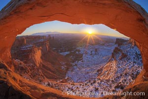
Mesa Arch spans 90 feet and stands at the edge of a mesa precipice thousands of feet above the Colorado River gorge. For a few moments at sunrise the underside of the arch glows dramatically red and orange.
Location: Island in the Sky, Canyonlands National Park, Utah
Image ID: 18085
Location: Island in the Sky, Canyonlands National Park, Utah
Image ID: 18085
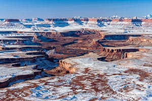
Soda Springs Basin in Canyonlands National Park, snow covered mesas and canyons, with the Green River far below, not far from its confluence with the Colorado River. Island in the Sky.
Location: Canyonlands National Park, Utah
Image ID: 18093
Location: Canyonlands National Park, Utah
Image ID: 18093
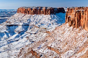
Canyonlands National Park, winter, viewed from Grandview Point. Island in the Sky.
Location: Canyonlands National Park, Utah
Image ID: 18097
Location: Canyonlands National Park, Utah
Image ID: 18097
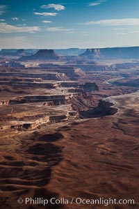
Soda Springs Basin from Green River Overlook, Island in the Sky, Canyonlands National Park, Utah.
Location: Canyonlands National Park, Utah
Image ID: 27840
Location: Canyonlands National Park, Utah
Image ID: 27840
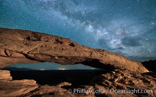
The Milky Way arching over Mesa Arch at night.
Location: Mesa Arch, Canyonlands National Park, Utah
Image ID: 27827
Location: Mesa Arch, Canyonlands National Park, Utah
Image ID: 27827
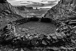
False Kiva at Sunset, Canyonlands National Park, Utah.
Location: False Kiva, Canyonlands National Park, Utah
Image ID: 28016
Location: False Kiva, Canyonlands National Park, Utah
Image ID: 28016
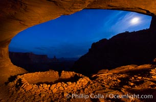
False Kiva at Sunset, Canyonlands National Park, Utah.
Location: False Kiva, Canyonlands National Park, Utah
Image ID: 28018
Location: False Kiva, Canyonlands National Park, Utah
Image ID: 28018

Green River Overlook, Canyonlands National Park.
Location: Canyonlands National Park, Utah
Image ID: 37866
Panorama dimensions: 5149 x 16421
Location: Canyonlands National Park, Utah
Image ID: 37866
Panorama dimensions: 5149 x 16421
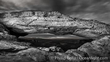
Mesa Arch at Night, Canyonlands National Park, Utah.
Location: Mesa Arch, Canyonlands National Park, Utah
Image ID: 29306
Location: Mesa Arch, Canyonlands National Park, Utah
Image ID: 29306
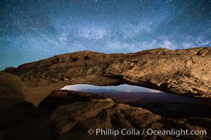
Mesa Arch and Milky Way at night.
Location: Mesa Arch, Canyonlands National Park, Utah
Image ID: 27826
Location: Mesa Arch, Canyonlands National Park, Utah
Image ID: 27826
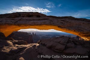
Mesa Arch Sunrise, Canyonlands National Park, Utah.
Location: Mesa Arch, Canyonlands National Park, Utah
Image ID: 29302
Location: Mesa Arch, Canyonlands National Park, Utah
Image ID: 29302
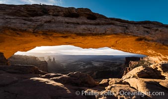
Mesa Arch Sunrise, Canyonlands National Park, Utah.
Location: Mesa Arch, Canyonlands National Park, Utah
Image ID: 29303
Location: Mesa Arch, Canyonlands National Park, Utah
Image ID: 29303
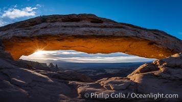
Mesa Arch Sunrise, Canyonlands National Park, Utah.
Location: Mesa Arch, Canyonlands National Park, Utah
Image ID: 29305
Panorama dimensions: 4676 x 8312
Location: Mesa Arch, Canyonlands National Park, Utah
Image ID: 29305
Panorama dimensions: 4676 x 8312
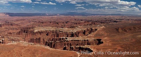
Canyonlands National Park panorama.
Location: Canyonlands National Park, Utah
Image ID: 27818
Panorama dimensions: 5510 x 13511
Location: Canyonlands National Park, Utah
Image ID: 27818
Panorama dimensions: 5510 x 13511

Canyonlands National Park panorama.
Location: Canyonlands National Park, Utah
Image ID: 27819
Panorama dimensions: 5275 x 22786
Location: Canyonlands National Park, Utah
Image ID: 27819
Panorama dimensions: 5275 x 22786
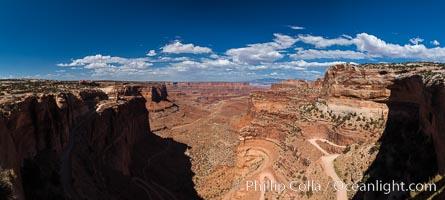
Canyonlands National Park panorama.
Location: Canyonlands National Park, Utah
Image ID: 27820
Panorama dimensions: 4920 x 10951
Location: Canyonlands National Park, Utah
Image ID: 27820
Panorama dimensions: 4920 x 10951
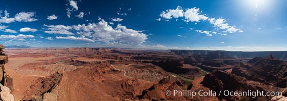
Canyonlands National Park panorama.
Location: Canyonlands National Park, Utah
Image ID: 27821
Panorama dimensions: 4813 x 13640
Location: Canyonlands National Park, Utah
Image ID: 27821
Panorama dimensions: 4813 x 13640
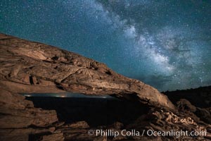
Mesa Arch and Milky Way at night.
Location: Mesa Arch, Canyonlands National Park, Utah
Image ID: 27828
Location: Mesa Arch, Canyonlands National Park, Utah
Image ID: 27828
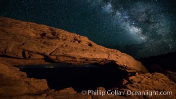
Mesa Arch and Milky Way at night.
Location: Mesa Arch, Canyonlands National Park, Utah
Image ID: 27829
Location: Mesa Arch, Canyonlands National Park, Utah
Image ID: 27829
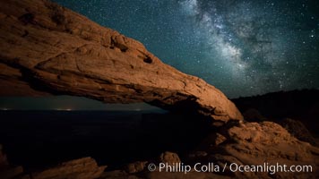
Mesa Arch and Milky Way at night.
Location: Mesa Arch, Canyonlands National Park, Utah
Image ID: 27830
Location: Mesa Arch, Canyonlands National Park, Utah
Image ID: 27830
