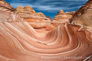
The Wave, an area of fantastic eroded sandstone featuring beautiful swirls, wild colors, countless striations, and bizarre shapes set amidst the dramatic surrounding North Coyote Buttes of Arizona and Utah. The sandstone formations of the North Coyote Buttes, including the Wave, date from the Jurassic period. Managed by the Bureau of Land Management, the Wave is located in the Paria Canyon-Vermilion Cliffs Wilderness and is accessible on foot by permit only.
Location: North Coyote Buttes, Paria Canyon-Vermilion Cliffs Wilderness, Arizona
Image ID: 20605
Location: North Coyote Buttes, Paria Canyon-Vermilion Cliffs Wilderness, Arizona
Image ID: 20605
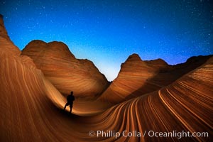
The Wave at Night, under a clear night sky full of stars. Photographer is illuminating the striated rocks with a small handheld light. The Wave, an area of fantastic eroded sandstone featuring beautiful swirls, wild colors, countless striations, and bizarre shapes is set amidst the dramatic surrounding North Coyote Buttes of Arizona and Utah. The sandstone formations of the North Coyote Buttes, including the Wave, date from the Jurassic period. Managed by the Bureau of Land Management, the Wave is located in the Paria Canyon-Vermilion Cliffs Wilderness and is accessible on foot by permit only.
Location: North Coyote Buttes, Paria Canyon-Vermilion Cliffs Wilderness, Arizona
Image ID: 28620
Location: North Coyote Buttes, Paria Canyon-Vermilion Cliffs Wilderness, Arizona
Image ID: 28620
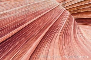
The Wave, an area of fantastic eroded sandstone featuring beautiful swirls, wild colors, countless striations, and bizarre shapes set amidst the dramatic surrounding North Coyote Buttes of Arizona and Utah. The sandstone formations of the North Coyote Buttes, including the Wave, date from the Jurassic period. Managed by the Bureau of Land Management, the Wave is located in the Paria Canyon-Vermilion Cliffs Wilderness and is accessible on foot by permit only.
Location: North Coyote Buttes, Paria Canyon-Vermilion Cliffs Wilderness, Arizona
Image ID: 20607
Location: North Coyote Buttes, Paria Canyon-Vermilion Cliffs Wilderness, Arizona
Image ID: 20607
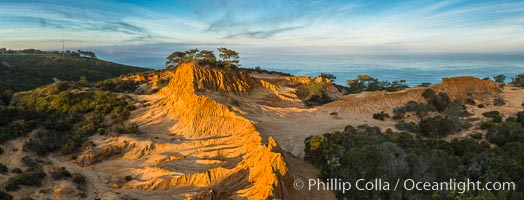
Broken Hill and view to La Jolla, panoramic photograph, from Torrey Pines State Reserve, sunrise.
Location: Torrey Pines State Reserve, San Diego, California
Image ID: 28397
Panorama dimensions: 4332 x 11344
Location: Torrey Pines State Reserve, San Diego, California
Image ID: 28397
Panorama dimensions: 4332 x 11344
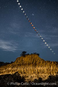
Lunar Eclipse Sequence Over Broken Hill, Torrey Pines State Reserve. While the moon lies in the full shadow of the earth (umbra) it receives only faint, red-tinged light refracted through the Earth's atmosphere. As the moon passes into the penumbra it receives increasing amounts of direct sunlight, eventually leaving the shadow of the Earth altogether. October 8, 2014.
Location: Torrey Pines State Reserve, San Diego, California
Image ID: 29412
Location: Torrey Pines State Reserve, San Diego, California
Image ID: 29412
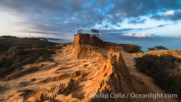
Clearing storm clouds over Broken Hill, overlooking La Jolla and the Pacific Ocean, Torrey Pines State Reserve.
Location: Torrey Pines State Reserve, San Diego, California
Image ID: 29416
Location: Torrey Pines State Reserve, San Diego, California
Image ID: 29416
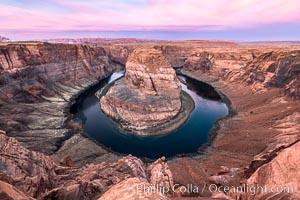
Spectacular Horseshoe Bend sunrise. The Colorado River makes a 180-degree turn at Horseshoe Bend. Here the river has eroded the Navajo sandstone for eons, digging a canyon 1100-feet deep.
Location: Horseshoe Bend, Page, Arizona
Image ID: 35939
Location: Horseshoe Bend, Page, Arizona
Image ID: 35939
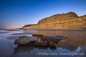
Torrey Pines Cliffs lit at night by a full moon, low tide reflections.
Location: Torrey Pines State Reserve, San Diego, California
Image ID: 28461
Location: Torrey Pines State Reserve, San Diego, California
Image ID: 28461
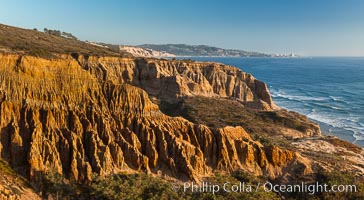
Torrey Pines Cliffs and Pacific Ocean, Razor Point view to La Jolla, San Diego, California.
Location: Torrey Pines State Reserve, San Diego, California
Image ID: 28487
Location: Torrey Pines State Reserve, San Diego, California
Image ID: 28487
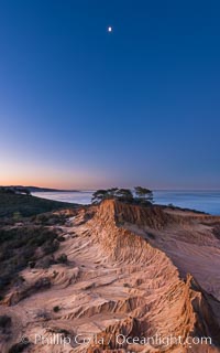
Quarter Moon over Broken Hill, Torrey Pines State Reserve.
Location: Torrey Pines State Reserve, San Diego, California
Image ID: 28366
Location: Torrey Pines State Reserve, San Diego, California
Image ID: 28366
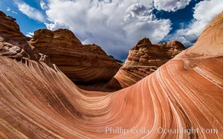
The Wave in the North Coyote Buttes, an area of fantastic eroded sandstone featuring beautiful swirls, wild colors, countless striations, and bizarre shapes set amidst the dramatic surrounding North Coyote Buttes of Arizona and Utah. The sandstone formations of the North Coyote Buttes, including the Wave, date from the Jurassic period. Managed by the Bureau of Land Management, the Wave is located in the Paria Canyon-Vermilion Cliffs Wilderness and is accessible on foot by permit only.
Location: North Coyote Buttes, Paria Canyon-Vermilion Cliffs Wilderness, Arizona
Image ID: 28601
Location: North Coyote Buttes, Paria Canyon-Vermilion Cliffs Wilderness, Arizona
Image ID: 28601
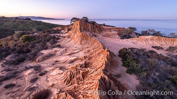
Broken Hill in soft pre-dawn light, overlooking the Pacific Ocean and Torrey Pines State Reserve. La Jolla and Mount Soledad in the distance.
Location: Torrey Pines State Reserve, San Diego, California
Image ID: 36564
Location: Torrey Pines State Reserve, San Diego, California
Image ID: 36564
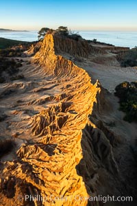
Broken Hill by the first light of dawn, overlooking the Pacific Ocean and Torrey Pines State Reserve.
Location: Torrey Pines State Reserve, San Diego, California
Image ID: 36567
Location: Torrey Pines State Reserve, San Diego, California
Image ID: 36567
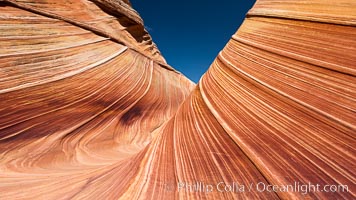
The Wave, an area of fantastic eroded sandstone featuring beautiful swirls, wild colors, countless striations, and bizarre shapes set amidst the dramatic surrounding North Coyote Buttes of Arizona and Utah. The sandstone formations of the North Coyote Buttes, including the Wave, date from the Jurassic period. Managed by the Bureau of Land Management, the Wave is located in the Paria Canyon-Vermilion Cliffs Wilderness and is accessible on foot by permit only.
Location: North Coyote Buttes, Paria Canyon-Vermilion Cliffs Wilderness, Arizona
Image ID: 20608
Location: North Coyote Buttes, Paria Canyon-Vermilion Cliffs Wilderness, Arizona
Image ID: 20608

Panorama of the Wave. The Wave is a sweeping, dramatic display of eroded sandstone, forged by eons of water and wind erosion, laying bare striations formed from compacted sand dunes over millenia. This panoramic picture is formed from thirteen individual photographs.
Location: North Coyote Buttes, Paria Canyon-Vermilion Cliffs Wilderness, Arizona
Image ID: 20700
Panorama dimensions: 4661 x 25458
Location: North Coyote Buttes, Paria Canyon-Vermilion Cliffs Wilderness, Arizona
Image ID: 20700
Panorama dimensions: 4661 x 25458
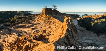
Broken Hill and view to La Jolla, panoramic photograph, from Torrey Pines State Reserve, sunrise.
Location: Torrey Pines State Reserve, San Diego, California
Image ID: 30469
Panorama dimensions: 6212 x 12960
Location: Torrey Pines State Reserve, San Diego, California
Image ID: 30469
Panorama dimensions: 6212 x 12960
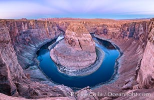
Belt of Venus over Horseshoe Bend on the Colorado River. The Colorado River makes a 180-degree turn at Horseshoe Bend. Here the river has eroded the Navajo sandstone for eons, digging a canyon 1100-feet deep. The Belt of Venus, or anti-twilight arch, is the shadow of the earth cast upon the atmosphere just above the horizon, and occurs a few minutes before sunrise or after sunset.
Location: Page, Arizona
Image ID: 37781
Panorama dimensions: 5719 x 8788
Location: Page, Arizona
Image ID: 37781
Panorama dimensions: 5719 x 8788
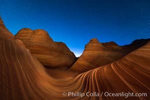
The Wave at Night, under a clear night sky full of stars. The Wave, an area of fantastic eroded sandstone featuring beautiful swirls, wild colors, countless striations, and bizarre shapes set amidst the dramatic surrounding North Coyote Buttes of Arizona and Utah. The sandstone formations of the North Coyote Buttes, including the Wave, date from the Jurassic period. Managed by the Bureau of Land Management, the Wave is located in the Paria Canyon-Vermilion Cliffs Wilderness and is accessible on foot by permit only.
Location: North Coyote Buttes, Paria Canyon-Vermilion Cliffs Wilderness, Arizona
Image ID: 28621
Location: North Coyote Buttes, Paria Canyon-Vermilion Cliffs Wilderness, Arizona
Image ID: 28621
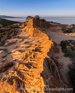
Sunrise over Broken Hill, overlooking La Jolla and the Pacific Ocean, Torrey Pines State Reserve.
Location: Torrey Pines State Reserve, San Diego, California
Image ID: 35844
Location: Torrey Pines State Reserve, San Diego, California
Image ID: 35844
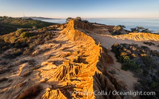
Sunrise over Broken Hill, overlooking La Jolla and the Pacific Ocean, Torrey Pines State Reserve.
Location: Torrey Pines State Reserve, San Diego, California
Image ID: 35845
Location: Torrey Pines State Reserve, San Diego, California
Image ID: 35845
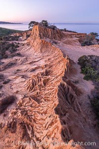
Broken Hill in soft pre-dawn light, overlooking the Pacific Ocean and Torrey Pines State Reserve.
Location: Torrey Pines State Reserve, San Diego, California
Image ID: 36565
Location: Torrey Pines State Reserve, San Diego, California
Image ID: 36565
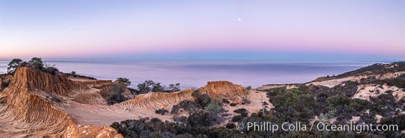
Earth Shadow over the Pacific, Torrey Pines, California.
Location: Torrey Pines State Reserve, San Diego, California
Image ID: 36566
Panorama dimensions: 4487 x 13160
Location: Torrey Pines State Reserve, San Diego, California
Image ID: 36566
Panorama dimensions: 4487 x 13160
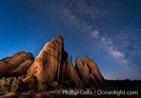
Milky Way over Sandstone Fins. Sandstone fins stand on edge. Vertical fractures separate standing plates of sandstone that are eroded into freestanding fins, that may one day further erode into arches.
Location: Arches National Park, Utah
Image ID: 29254
Location: Arches National Park, Utah
Image ID: 29254
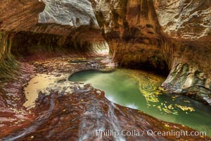
The Subway, a iconic eroded sandstone formation in Zion National Park.
Location: The Subway, Zion National Park, Utah
Image ID: 26092
Location: The Subway, Zion National Park, Utah
Image ID: 26092
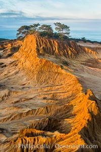
Broken Hill and view to La Jolla, from Torrey Pines State Reserve, sunrise.
Location: Torrey Pines State Reserve, San Diego, California
Image ID: 28395
Location: Torrey Pines State Reserve, San Diego, California
Image ID: 28395
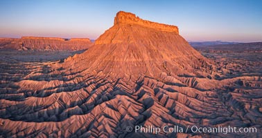
Factory Butte at sunrise. An exceptional example of solitary butte surrounded by dramatically eroded badlands, Factory Butte stands alone on the San Rafael Swell.
Location: Factory Butte, Hanksville, Utah
Image ID: 38054
Location: Factory Butte, Hanksville, Utah
Image ID: 38054
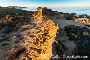
Broken Hill by the first light of dawn, overlooking the Pacific Ocean and Torrey Pines State Reserve, La Jolla and Mount Soledad in the distance.
Location: Torrey Pines State Reserve, San Diego, California
Image ID: 36568
Location: Torrey Pines State Reserve, San Diego, California
Image ID: 36568
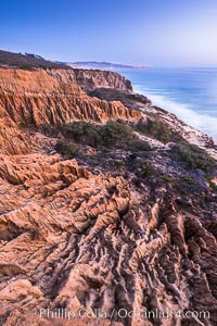
Torrey Pines Cliffs and Pacific Ocean, Razor Point view to La Jolla, San Diego, California.
Location: Torrey Pines State Reserve, San Diego, California
Image ID: 28485
Location: Torrey Pines State Reserve, San Diego, California
Image ID: 28485
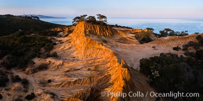
Broken Hill and view to La Jolla, panoramic photograph, from Torrey Pines State Reserve, sunrise.
Location: Torrey Pines State Reserve, San Diego, California
Image ID: 28464
Panorama dimensions: 3867 x 7787
Location: Torrey Pines State Reserve, San Diego, California
Image ID: 28464
Panorama dimensions: 3867 x 7787
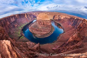
Horseshoe Bend. The Colorado River makes a 180-degree turn at Horseshoe Bend. Here the river has eroded the Navajo sandstone for eons, digging a canyon 1100-feet deep.
Location: Horseshoe Bend, Page, Arizona
Image ID: 26602
Location: Horseshoe Bend, Page, Arizona
Image ID: 26602