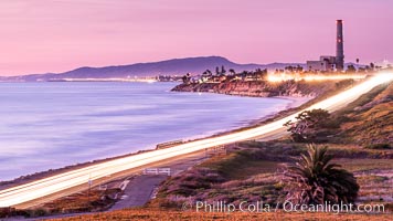
Carlsbad Coast Highway Sunset, from Terramar and North Ponto to Oceanside and Camp Pendleton. The smoke stack that marked the old Encina Power Plant was removed in 2021. Oceanside Pier is seen beautifully lit in the distance. Rising in the distance is San Onofre Mountain (1722') topped by a tall signal tower, one of the southern peaks in the Santa Ana Mountains.
Location: Carlsbad, California
Image ID: 37479
Location: Carlsbad, California
Image ID: 37479

Carlsbad Coast at Sunset, Terramar and the Oceanside Pier, with Camp Pendleton and the San Onofre power plant in the distance on this incredibly clean and crisp evening view. Rising in the distance is San Onofre Mountain (1722') topped by a tall signal tower, one of the southern peaks in the Santa Ana Mountains.
Location: Carlsbad, California
Image ID: 37482
Panorama dimensions: 1106 x 3500
Location: Carlsbad, California
Image ID: 37482
Panorama dimensions: 1106 x 3500
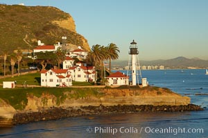
New Point Loma Lighthouse, situated on the tip of Point Loma Peninsula, marks the entrance to San Diego Bay. The lighthouse rises 70' and was built in 1891 to replace the "old" Point Loma Lighthouse which was often shrouded in fog.
Location: San Diego, California
Image ID: 22295
Location: San Diego, California
Image ID: 22295

Carlsbad Coast Highway Sunset, Terramar and North Ponto to Oceanside with Camp Pendleton in the distance. Rising in the distance is San Onofre Mountain (1722') topped by a tall signal tower, one of the southern peaks in the Santa Ana Mountains.
Location: Carlsbad, California
Image ID: 35902
Location: Carlsbad, California
Image ID: 35902
Sunset on Terra Mar and the Carlsbad coastline, looking north to Oceanside, Camp Pendleton and San Onofre. The Oceanside Pier, lit up at night, is seen further up the coast. Rising in the distance is San Onofre Mountain (1722') topped by a tall signal tower, one of the southern peaks in the Santa Ana Mountains.
Image ID: 36117
Image ID: 36117

Carlsbad Coast Highway Sunset, Terramar and North Ponto to Oceanside with Camp Pendleton in the distance. Rising in the distance is San Onofre Mountain (1722') topped by a tall signal tower, one of the southern peaks in the Santa Ana Mountains.
Location: Carlsbad, California
Image ID: 37478
Location: Carlsbad, California
Image ID: 37478

Elephant seals crowd a sand beach at the Piedras Blancas rookery near San Simeon.
Location: Piedras Blancas, San Simeon, California
Image ID: 35140
Location: Piedras Blancas, San Simeon, California
Image ID: 35140
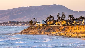
Terramar Sunset, viewed from North Ponto with Oceanside and Camp Pendleton in the distance. Rising in the distance is San Onofre Mountain (1722') topped by a tall signal tower, one of the southern peaks in the Santa Ana Mountains.
Location: Carlsbad, California
Image ID: 36743
Location: Carlsbad, California
Image ID: 36743
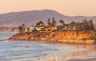
Terramar Sunset, viewed from North Ponto with Oceanside and Camp Pendleton in the distance. Rising in the distance is San Onofre Mountain (1722') topped by a tall signal tower, one of the southern peaks in the Santa Ana Mountains.
Location: Carlsbad, California
Image ID: 35903
Location: Carlsbad, California
Image ID: 35903

Carlsbad Coast Highway Sunset, North Ponto to Oceanside with Camp Pendleton in the distance. Rising in the distance is San Onofre Mountain (1722') topped by a tall signal tower, one of the southern peaks in the Santa Ana Mountains.
Location: Carlsbad, California
Image ID: 35905
Location: Carlsbad, California
Image ID: 35905
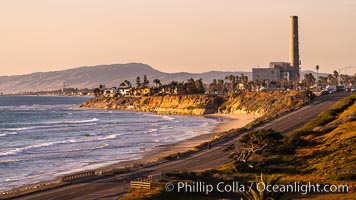
Sunset on Terra Mar and the Carlsbad coastline, looking north to Oceanside, Camp Pendleton and San Onofre. Rising in the distance is San Onofre Mountain (1722') topped by a tall signal tower, one of the southern peaks in the Santa Ana Mountains.
Image ID: 36116
Image ID: 36116
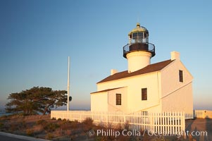
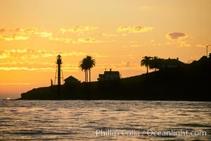
The old Point Loma lighthouse operated from 1855 to 1891 above the entrance to San Diego Bay. It is now a maintained by the National Park Service and is part of Cabrillo National Monument.
Location: Cabrillo National Monument, San Diego, California
Image ID: 14522
Location: Cabrillo National Monument, San Diego, California
Image ID: 14522
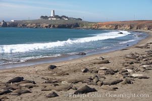
Elephant seals crowd a sand beach at the Piedras Blancas rookery near San Simeon. The Piedras Blancas lighthouse is visible in upper left.
Location: Piedras Blancas, San Simeon, California
Image ID: 20355
Location: Piedras Blancas, San Simeon, California
Image ID: 20355

Elephant seals crowd a sand beach at the Piedras Blancas rookery near San Simeon.
Location: Piedras Blancas, San Simeon, California
Image ID: 20358
Location: Piedras Blancas, San Simeon, California
Image ID: 20358

Guadalupe Island at sunrise, panorama. Volcanic coastline south of Pilot Rock and Spanish Cove, near El Faro lighthouse.
Location: Guadalupe Island (Isla Guadalupe), Baja California, Mexico
Image ID: 19497
Panorama dimensions: 2797 x 16157
Location: Guadalupe Island (Isla Guadalupe), Baja California, Mexico
Image ID: 19497
Panorama dimensions: 2797 x 16157
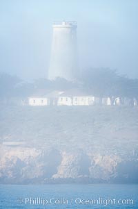
Piedras Blancas lighthouse. Completed in 1875, the 115-foot-tall Piedras Blancas lighthouse is one of the few tall-style lighthouses on the West Coast of the United States. Piedras Blancas, named for a group of three white rocks just offshore, is north of San Simeon, California very close to Hearst Castle.
Location: Piedras Blancas, San Simeon, California
Image ID: 20348
Location: Piedras Blancas, San Simeon, California
Image ID: 20348

Hills between Morro Bay and Atascadero, early morning light, power transmission lines and signal attenae.
Location: Morro Bay, California
Image ID: 22220
Location: Morro Bay, California
Image ID: 22220

Hills between Morro Bay and Atascadero, early morning light, power transmission lines and signal attenae.
Location: Morro Bay, California
Image ID: 22221
Location: Morro Bay, California
Image ID: 22221
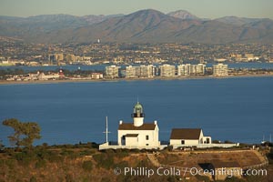
Old Point Loma Lighthouse, sitting high atop the end of Point Loma peninsula, seen here with San Diego Bay and downtown San Diego in the distance. The old Point Loma lighthouse operated from 1855 to 1891 above the entrance to San Diego Bay. It is now a maintained by the National Park Service and is part of Cabrillo National Monument.
Location: San Diego, California
Image ID: 22301
Location: San Diego, California
Image ID: 22301
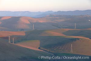
Hills between Morro Bay and Atascadero, early morning light, power transmission lines and signal attenae.
Location: Morro Bay, California
Image ID: 22217
Location: Morro Bay, California
Image ID: 22217

Hills between Morro Bay and Atascadero, early morning light, power transmission lines and signal attenae.
Location: Morro Bay, California
Image ID: 22222
Location: Morro Bay, California
Image ID: 22222
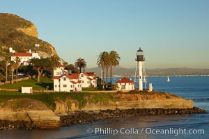
New Point Loma Lighthouse, situated on the tip of Point Loma Peninsula, marks the entrance to San Diego Bay. The lighthouse rises 70' and was built in 1891 to replace the "old" Point Loma Lighthouse which was often shrouded in fog.
Location: San Diego, California
Image ID: 22347
Location: San Diego, California
Image ID: 22347
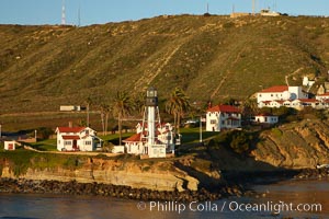
New Point Loma Lighthouse, situated on the tip of Point Loma Peninsula, marks the entrance to San Diego Bay. The lighthouse rises 70' and was built in 1891 to replace the "old" Point Loma Lighthouse which was often shrouded in fog.
Location: San Diego, California
Image ID: 22372
Location: San Diego, California
Image ID: 22372
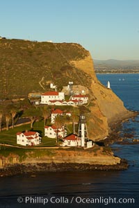
New Point Loma Lighthouse, situated on the tip of Point Loma Peninsula, marks the entrance to San Diego Bay. The lighthouse rises 70' and was built in 1891 to replace the "old" Point Loma Lighthouse which was often shrouded in fog.
Location: San Diego, California
Image ID: 22398
Location: San Diego, California
Image ID: 22398
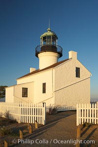
The old Point Loma lighthouse operated from 1855 to 1891 above the entrance to San Diego Bay. It is now a maintained by the National Park Service and is part of Cabrillo National Monument.
Location: Cabrillo National Monument, San Diego, California
Image ID: 14521
Location: Cabrillo National Monument, San Diego, California
Image ID: 14521
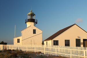
The old Point Loma lighthouse operated from 1855 to 1891 above the entrance to San Diego Bay. It is now a maintained by the National Park Service and is part of Cabrillo National Monument.
Location: Cabrillo National Monument, San Diego, California
Image ID: 14523
Location: Cabrillo National Monument, San Diego, California
Image ID: 14523
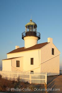
The old Point Loma lighthouse operated from 1855 to 1891 above the entrance to San Diego Bay. It is now a maintained by the National Park Service and is part of Cabrillo National Monument.
Location: Cabrillo National Monument, San Diego, California
Image ID: 14524
Location: Cabrillo National Monument, San Diego, California
Image ID: 14524
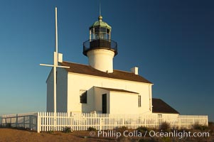
The old Point Loma lighthouse operated from 1855 to 1891 above the entrance to San Diego Bay. It is now a maintained by the National Park Service and is part of Cabrillo National Monument.
Location: Cabrillo National Monument, San Diego, California
Image ID: 14525
Location: Cabrillo National Monument, San Diego, California
Image ID: 14525
