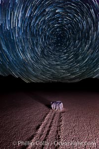
Racetrack sailing stone and star trails. A sliding rock of the Racetrack Playa. The sliding rocks, or sailing stones, move across the mud flats of the Racetrack Playa, leaving trails behind in the mud. The explanation for their movement is not known with certainty, but many believe wind pushes the rocks over wet and perhaps icy mud in winter.
Location: Racetrack Playa, Death Valley National Park, California
Image ID: 27671
Location: Racetrack Playa, Death Valley National Park, California
Image ID: 27671
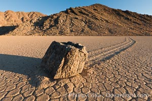
Sailing stone on the Racetrack Playa. The sliding rocks, or sailing stones, move across the mud flats of the Racetrack Playa, leaving trails behind in the mud. The explanation for their movement is not known with certainty, but many believe wind pushes the rocks over wet and perhaps icy mud in winter.
Location: Racetrack Playa, Death Valley National Park, California
Image ID: 27689
Location: Racetrack Playa, Death Valley National Park, California
Image ID: 27689
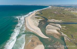
Aerial Photo of Tijuana River Mouth SMCA. Tijuana River Mouth State Marine Conservation Area borders Imperial Beach and the Mexican Border.
Location: Imperial Beach, California
Image ID: 30660
Location: Imperial Beach, California
Image ID: 30660
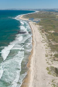
Aerial Photo of Tijuana River Mouth SMCA. Tijuana River Mouth State Marine Conservation Area borders Imperial Beach and the Mexican Border.
Location: Imperial Beach, California
Image ID: 30649
Location: Imperial Beach, California
Image ID: 30649
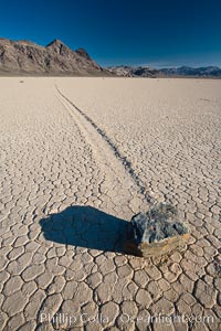
A sliding rock of the Racetrack Playa. The sliding rocks, or sailing stones, move across the mud flats of the Racetrack Playa, leaving trails behind in the mud. The explanation for their movement is not known with certainty, but many believe wind pushes the rocks over wet and perhaps icy mud in winter.
Location: Racetrack Playa, Death Valley National Park, California
Image ID: 25239
Location: Racetrack Playa, Death Valley National Park, California
Image ID: 25239
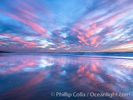
Spectacular Sunset, Terramar Beach, Carlsbad. Pink and Purple pastel hues are mirrored on the wet side as the tide retreats.
Location: Carlsbad, California
Image ID: 36754
Location: Carlsbad, California
Image ID: 36754
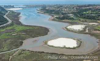
Aerial photo of Batiquitos Lagoon, Carlsbad. The Batiquitos Lagoon is a coastal wetland in southern Carlsbad, California. Part of the lagoon is designated as the Batiquitos Lagoon State Marine Conservation Area, run by the California Department of Fish and Game as a nature reserve.
Location: Carlsbad, Callifornia
Image ID: 30563
Location: Carlsbad, Callifornia
Image ID: 30563
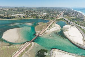
Aerial photo of Batiquitos Lagoon, Carlsbad. The Batiquitos Lagoon is a coastal wetland in southern Carlsbad, California. Part of the lagoon is designated as the Batiquitos Lagoon State Marine Conservation Area, run by the California Department of Fish and Game as a nature reserve.
Location: Carlsbad, Callifornia
Image ID: 30569
Location: Carlsbad, Callifornia
Image ID: 30569
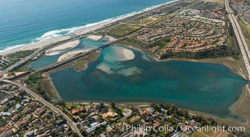
Aerial photo of Batiquitos Lagoon, Carlsbad. The Batiquitos Lagoon is a coastal wetland in southern Carlsbad, California. Part of the lagoon is designated as the Batiquitos Lagoon State Marine Conservation Area, run by the California Department of Fish and Game as a nature reserve.
Location: Carlsbad, Callifornia
Image ID: 30665
Location: Carlsbad, Callifornia
Image ID: 30665
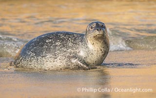
Chonky Pacific harbor seal on wet gold-colored sandy beach in La Jolla.
Location: La Jolla, California
Image ID: 39833
Location: La Jolla, California
Image ID: 39833
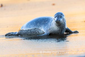
Pacific harbor seal profile portrait on wet gold-colored sandy beach at sunrise in La Jolla.
Location: La Jolla, California
Image ID: 40818
Location: La Jolla, California
Image ID: 40818
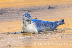
Pacific harbor seal profile portrait on wet gold-colored sandy beach at sunrise in La Jolla.
Location: La Jolla, California
Image ID: 40820
Location: La Jolla, California
Image ID: 40820
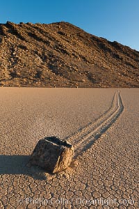
Sailing stone on the Racetrack Playa. The sliding rocks, or sailing stones, move across the mud flats of the Racetrack Playa, leaving trails behind in the mud. The explanation for their movement is not known with certainty, but many believe wind pushes the rocks over wet and perhaps icy mud in winter.
Location: Racetrack Playa, Death Valley National Park, California
Image ID: 27691
Location: Racetrack Playa, Death Valley National Park, California
Image ID: 27691
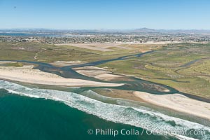
Aerial Photo of Tijuana River Mouth SMCA. Tijuana River Mouth State Marine Conservation Area borders Imperial Beach and the Mexican Border.
Location: Imperial Beach, California
Image ID: 30648
Location: Imperial Beach, California
Image ID: 30648
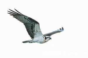
Osprey in Flight in La Jolla.
Species: Osprey, Pandion haliaetus
Location: La Jolla, California
Image ID: 39854
Species: Osprey, Pandion haliaetus
Location: La Jolla, California
Image ID: 39854

Osprey in Flight in La Jolla.
Species: Osprey, Pandion haliaetus
Location: La Jolla, California
Image ID: 39855
Species: Osprey, Pandion haliaetus
Location: La Jolla, California
Image ID: 39855
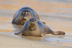
Pacific harbor seal on wet sandy beach.
Species: Pacific harbor seal, Phoca vitulina richardsi
Location: La Jolla, California
Image ID: 20214
Species: Pacific harbor seal, Phoca vitulina richardsi
Location: La Jolla, California
Image ID: 20214

Leucadia wet sand beach and sea cliffs, sunset.
Location: Leucadia, Encinitas, California
Image ID: 27377
Panorama dimensions: 5147 x 16216
Location: Leucadia, Encinitas, California
Image ID: 27377
Panorama dimensions: 5147 x 16216
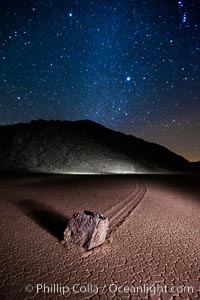
Racetrack sailing stone and Milky Way, at night. A sliding rock of the Racetrack Playa. The sliding rocks, or sailing stones, move across the mud flats of the Racetrack Playa, leaving trails behind in the mud. The explanation for their movement is not known with certainty, but many believe wind pushes the rocks over wet and perhaps icy mud in winter.
Location: Racetrack Playa, Death Valley National Park, California
Image ID: 27640
Location: Racetrack Playa, Death Valley National Park, California
Image ID: 27640
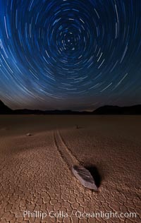
Racetrack sailing stone and star trails. A sliding rock of the Racetrack Playa. The sliding rocks, or sailing stones, move across the mud flats of the Racetrack Playa, leaving trails behind in the mud. The explanation for their movement is not known with certainty, but many believe wind pushes the rocks over wet and perhaps icy mud in winter.
Location: Racetrack Playa, Death Valley National Park, California
Image ID: 27667
Location: Racetrack Playa, Death Valley National Park, California
Image ID: 27667
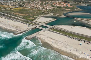
Aerial photo of Batiquitos Lagoon, Carlsbad. The Batiquitos Lagoon is a coastal wetland in southern Carlsbad, California. Part of the lagoon is designated as the Batiquitos Lagoon State Marine Conservation Area, run by the California Department of Fish and Game as a nature reserve.
Location: Carlsbad, Callifornia
Image ID: 30556
Location: Carlsbad, Callifornia
Image ID: 30556
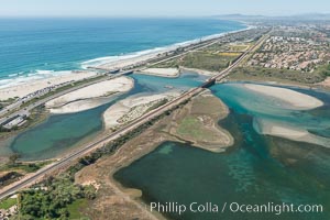
Aerial photo of Batiquitos Lagoon, Carlsbad. The Batiquitos Lagoon is a coastal wetland in southern Carlsbad, California. Part of the lagoon is designated as the Batiquitos Lagoon State Marine Conservation Area, run by the California Department of Fish and Game as a nature reserve.
Location: Carlsbad, Callifornia
Image ID: 30558
Location: Carlsbad, Callifornia
Image ID: 30558
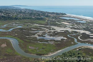
Aerial Photo of San Elijo Lagoon. San Elijo Lagoon Ecological Reserve is one of the largest remaining coastal wetlands in San Diego County, California, on the border of Encinitas, Solana Beach and Rancho Santa Fe.
Location: Encinitas, California
Image ID: 30592
Location: Encinitas, California
Image ID: 30592
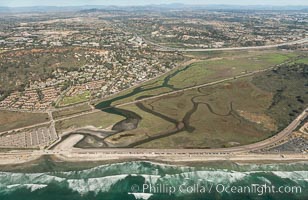
Aerial photo of Los Penasquitos Lagoon. Los Peñasquitos Marsh Natural Preserve and Lagoon is a coastal marsh in San Diego County, California, USA situated at the northern edge of the City of San Diego, forming the natural border with Del Mar, California.
Location: Del Mar, California
Image ID: 30602
Location: Del Mar, California
Image ID: 30602
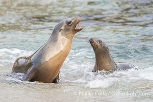
Two Young California Sea Lions on a Wet Sand Beach in La Jolla, La Jolla Cove.
Species: California sea lion, Zalophus californianus
Location: La Jolla, California
Image ID: 39835
Species: California sea lion, Zalophus californianus
Location: La Jolla, California
Image ID: 39835
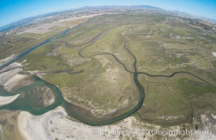
Aerial Photo of Tijuana River Mouth SMCA. Tijuana River Mouth State Marine Conservation Area borders Imperial Beach and the Mexican Border.
Location: Imperial Beach, California
Image ID: 30659
Location: Imperial Beach, California
Image ID: 30659
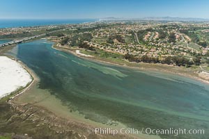
Aerial photo of Batiquitos Lagoon, Carlsbad. The Batiquitos Lagoon is a coastal wetland in southern Carlsbad, California. Part of the lagoon is designated as the Batiquitos Lagoon State Marine Conservation Area, run by the California Department of Fish and Game as a nature reserve.
Location: Carlsbad, Callifornia
Image ID: 30561
Location: Carlsbad, Callifornia
Image ID: 30561
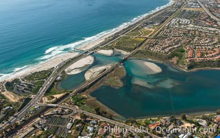
Aerial photo of Batiquitos Lagoon, Carlsbad. The Batiquitos Lagoon is a coastal wetland in southern Carlsbad, California. Part of the lagoon is designated as the Batiquitos Lagoon State Marine Conservation Area, run by the California Department of Fish and Game as a nature reserve.
Location: Carlsbad, Callifornia
Image ID: 30572
Location: Carlsbad, Callifornia
Image ID: 30572
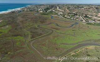
Aerial Photo of San Elijo Lagoon. San Elijo Lagoon Ecological Reserve is one of the largest remaining coastal wetlands in San Diego County, California, on the border of Encinitas, Solana Beach and Rancho Santa Fe.
Location: Encinitas, California
Image ID: 30584
Location: Encinitas, California
Image ID: 30584
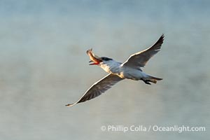
Forster's Tern in Flight with Prey, Sterna forsteri.
Species: Forsters Tern, Sterna forsteri
Location: Bolsa Chica State Ecological Reserve, Huntington Beach, California
Image ID: 40029
Species: Forsters Tern, Sterna forsteri
Location: Bolsa Chica State Ecological Reserve, Huntington Beach, California
Image ID: 40029