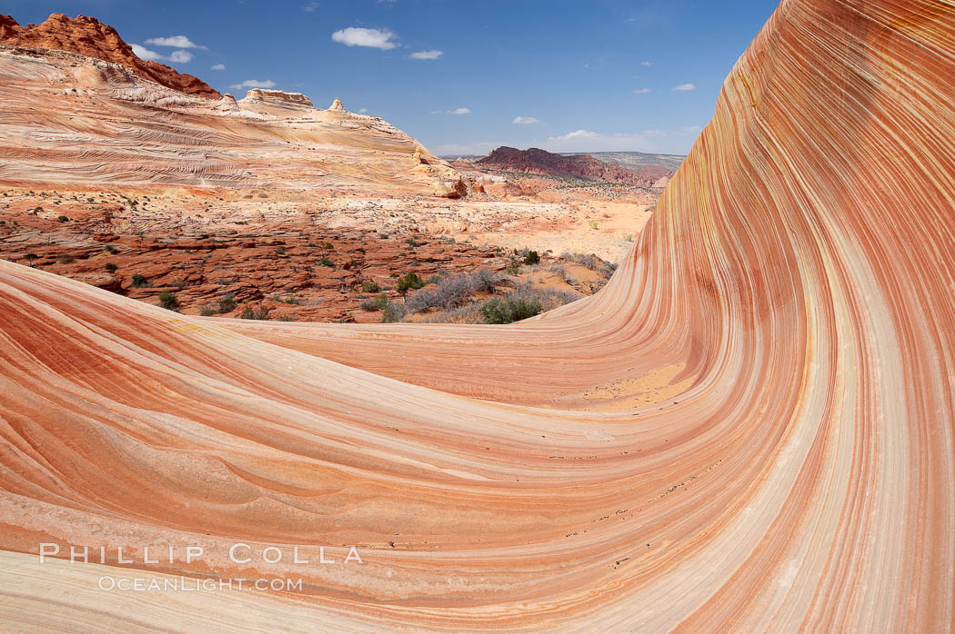
The walk to the the Wave is really not all that difficult. There are only a few hundred feet of elevation gain, and it is only about 3 miles from trailhead to the Wave proper, so one would be hard-pressed indeed to consider it anything more than a moderate hike. The terrain is wonderful and varied: striated and eroded sandstone slopes, dramatic buttes and a number of large cones are seen along the way. Some of the trail is soft sand, while the rest is sandstone slickrock. Lightweight hiking boots (the kind with grippy soles for adhering to the slickrock) or running shoes are what is called for in this area. I tried to use my walk as a workout in lieu of my daily run, travelling out to the Wave at a fairly quick clip, only stopping once for a photo. Nevertheless, in spite of the pace I was able to admire the grand surroundings that rose up around me. About 60 minutes after leaving the trailhead I reached the top of the final sandy section of the trail and had arrived at the entrance to the Wave. Turning around to view the area I had just covered gave this view. Note the bluff in the distance, in the upper left of the photo: the entire bluff is an amazing cross-hatched display of stratified sandstone, with every shade of red, yellow and orange imaginable. In the foreground is the bowl-like entrance to the Wave. More tomorrow.
The Wave, an area of fantastic eroded sandstone featuring beautiful swirls, wild colors, countless striations, and bizarre shapes set amidst the dramatic surrounding North Coyote Buttes of Arizona and Utah. The sandstone formations of the North Coyote Buttes, including the Wave, date from the Jurassic period. Managed by the Bureau of Land Management, the Wave is located in the Paria Canyon-Vermilion Cliffs Wilderness and is accessible on foot by permit only.
Image ID: 20644
Location: North Coyote Buttes, Paria Canyon-Vermilion Cliffs Wilderness, Arizona, USA
In case you want some GPS coordinates, here are the ones I logged on my walk. They roughly correspond to the GPS coordinates provided by the BLM, with a couple additional ones thrown in for good measure. I found that my GPS differed from the BLM waypoints by 50-100′ or so and decided it was best to store my own series of waypoints on my walk to the Wave since I was planning to return to my car after sunset in enough darkness that I would not be able to rely on the visual cues that make the hike simple in the daytime. (As it turned out the return to the car was still pretty straightforward after sunset, in spite of the lack of light — I did not need to use the GPS.)
37.02000, -112.01589 (Wire Pass trailhead)
37.01723, -112.01313
37.01541, -112.00893
37.01311, -112.00835
37.01015, -112.00832
37.00328, -112.00689
36.99945, -112.00633
36.99597, -112.00619 (The Wave)


