Conness Lakes is one of my favorite hikes in the Sierra Nevada. Within just a few miles of the trailhead I can be standing in a granite cirque surrounded by 12,000-foot peaks with several beautiful glacier-fed lakes within easy reach. Alone. I try to return every few years, and managed to get up there last weekend. My goal was to reach lower Conness Lake with early morning light, but not so early that the lake would be in shadow. Here is the view I had where I sat down for second breakfast and enjoyed being alive:

North Peak (12,242') rises over lower Conness Lake, its water colored deep blue-green by glacier runoff. Mount Conness (12,589') towers in the upper left. Hoover Wilderness, Inyo National Forest.
Image ID: 36427
Location: Conness Lakes Basin, Hoover Wilderness, California, USA
I had to drive from Bass Lake to Lake Tahoe and elected to take the route over Tioga Pass, driving through the sunrise in Tuolumne Meadows before reaching the Saddlebag Lake trailhead at 7am. There is a boat shuttle in summer that takes hikers the length of Saddlebag Lake but I have never taken it since I need the exercise. I put my food in a bear locker and set out. There were no mosquitoes, thankfully. The view from the Saddlebag Lake resort looking west, is classic Sierra Nevada. The trail on the southwest side of Saddlebag Lake is the shortest route to the far end. To reach it cross over the dam but make sure you have good protection on your feet since the first mile is rocky scree.

Above: iphone shot of view from Saddlebag Lake trailhead

Above: iphone shot of rocky trail along Saddlebag Lake, flip flips don't work here

Above: flowers along Greenstone Lake, iphone
Once at the far (northwest) end of Saddlebag Lake, the really beautiful hiking begins. Narrow fishermen’s trails run through grassy meadows around the perimeter of Greenstone Lake with nice views in all directions. I stay on the south side of Greenstone Lake, keeping the lake on my right, for views like these:

Greenstone Lake and North Peak, Hoover Wilderness.
Image ID: 36420
Location: 20 Lakes Basin, Hoover Wilderness, California, USA
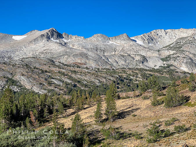
You start to get peek-a-boo views of Mount Conness and the glacier basin 400′ above you. You’ll be there in 45 minutes. At the western end of Greenstone Lake you will cross over Lee Vining Creek. It’s usually pretty easy but in spring the melt may be strong enough that your feet will get wet. After crossing, the trail meanders westward along Lee Vining Creek with the creek on your left and ascends through trees and beautiful grassy areas. Ahead and above you will see a small waterfall where Lee Vining Creek exits the Conness Lakes Basin. You can just make it out in the photo below, directly below North Peak. Keep the falls and the tree-covered area adjacent to the creek on your left, sticking to the open rocky area as you ascend the slope. The trail is clear here until the end where it bounces among the rocks a little.

Lee Vining Creek below Conness Lakes, Twenty Lakes Basin near Conness Lakes.
Image ID: 36423
Location: 20 Lakes Basin, Hoover Wilderness, California, USA

Twenty Lakes Basin near Conness Lakes, Hoover Wilderness.
Image ID: 31056
Location: 20 Lakes Basin, Hoover Wilderness, California, USA
Once you reach the top of the boulder slope the hard work is over. The outlet of lower Conness Lake is in front of you, with North Peak to the right and Mount Conness in the distance. The views are spectacular. Trails will take you around either side of the lower lake. If you stick to the right and take the trail that ascends, you can head toward the summit of North Peak. I like to stay on the left side of the lower lake, ascending up the steep slope to reach the middle and upper lakes. This area is one of the best picnic spots in the Sierra Nevada. Once it’s time to return, you can follow the same trail back to your car. Or, as you descend the slope from lower Conness Lake stay left, going overland to the northeast toward Wasco Lake and eventually hooking up with the 20 Lakes Basin loop trail. Cheers, and thanks for looking!

Mount Conness (12,589') over Lower Conness Lake, Hoover Wilderness.
Image ID: 36424
Location: Conness Lakes Basin, Hoover Wilderness, California, USA

Mount Conness and North Peak over middle Conness Lake, Hoover Wilderness.
Image ID: 36426
Location: Conness Lakes Basin, Hoover Wilderness, California, USA

Greenstone Lake and Saddlebag Lake in the 20 Lakes Basin, Hoover Wilderness.
Image ID: 36428
Location: 20 Lakes Basin, Hoover Wilderness, California, USA

Conness Lake with green glacial meltwaters, Hoover Wilderness.
Image ID: 31067
Location: Conness Lakes Basin, Hoover Wilderness, California, USA


