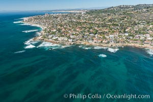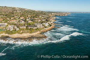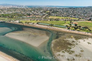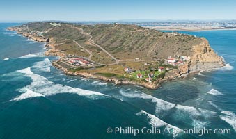
Aerial Photo of Cabrillo State Marine Reserve, Point Loma, San Diego.
Location: San Diego, California
Image ID: 30641
Location: San Diego, California
Image ID: 30641
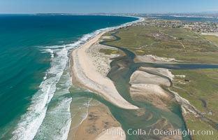
Aerial Photo of Tijuana River Mouth SMCA. Tijuana River Mouth State Marine Conservation Area borders Imperial Beach and the Mexican Border.
Location: Imperial Beach, California
Image ID: 30660
Location: Imperial Beach, California
Image ID: 30660
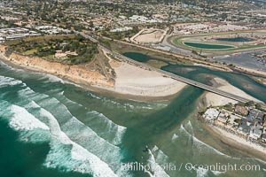
Aerial photo of San Dieguito Lagoon and Dog Beach. San Dieguito Lagoon State Marine Conservation Area (SMCA) is a marine protected area near Del Mar in San Diego County.
Location: Del Mar, California
Image ID: 30604
Location: Del Mar, California
Image ID: 30604
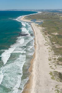
Aerial Photo of Tijuana River Mouth SMCA. Tijuana River Mouth State Marine Conservation Area borders Imperial Beach and the Mexican Border.
Location: Imperial Beach, California
Image ID: 30649
Location: Imperial Beach, California
Image ID: 30649
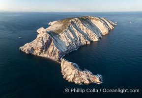
Isla San Pedro Martir at sunset with extensive forest of Cardon Cactus seen on the summit ridge of the island, aerial photo, Sea of Cortez, Mexico. San Pedro Martir Island and its marine life are, since 2002, part of the San Pedro Martir Biosphere Reserve, and is regarded as a natural laboratory of adaptive evolution, similar to that of the Galapagos Islands. It is home to 292 species of fauna and flora (both land-based and aquatic), with 42 species protected by Mexican law, and 30 listed on the Red List of Threatened Species. San Pedro Martir is also unique in the area for its year-round quantity of birds. The island is the only island in the area with a perpetually swirling cloud of sea birds. This is because the water around the island, has some of the most successful marine productivity in the world.
Location: Isla San Pedro Martir, Sonora, Mexico
Image ID: 40397
Location: Isla San Pedro Martir, Sonora, Mexico
Image ID: 40397
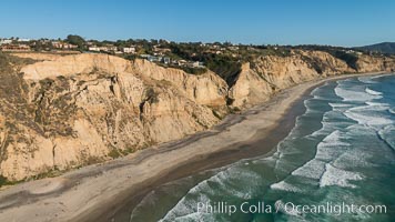
Aerial Photo of San Diego Scripps Coastal SMCA. Blacks Beach and Torrey Pines State Reserve.
Location: La Jolla, California
Image ID: 30736
Location: La Jolla, California
Image ID: 30736
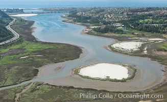
Aerial photo of Batiquitos Lagoon, Carlsbad. The Batiquitos Lagoon is a coastal wetland in southern Carlsbad, California. Part of the lagoon is designated as the Batiquitos Lagoon State Marine Conservation Area, run by the California Department of Fish and Game as a nature reserve.
Location: Carlsbad, Callifornia
Image ID: 30563
Location: Carlsbad, Callifornia
Image ID: 30563
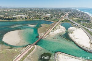
Aerial photo of Batiquitos Lagoon, Carlsbad. The Batiquitos Lagoon is a coastal wetland in southern Carlsbad, California. Part of the lagoon is designated as the Batiquitos Lagoon State Marine Conservation Area, run by the California Department of Fish and Game as a nature reserve.
Location: Carlsbad, Callifornia
Image ID: 30569
Location: Carlsbad, Callifornia
Image ID: 30569
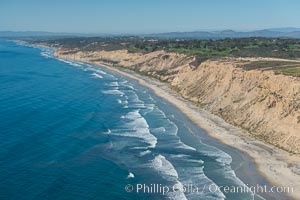
Aerial Photo of San Diego Scripps Coastal SMCA. Blacks Beach and Torrey Pines State Reserve.
Location: La Jolla, California
Image ID: 30622
Location: La Jolla, California
Image ID: 30622
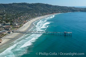
Aerial Photo of San Diego Scripps Coastal SMCA. Scripps Institution of Oceanography Research Pier.
Location: Scripps Institution of Oceanography, La Jolla, California
Image ID: 30626
Location: Scripps Institution of Oceanography, La Jolla, California
Image ID: 30626
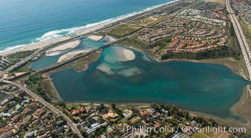
Aerial photo of Batiquitos Lagoon, Carlsbad. The Batiquitos Lagoon is a coastal wetland in southern Carlsbad, California. Part of the lagoon is designated as the Batiquitos Lagoon State Marine Conservation Area, run by the California Department of Fish and Game as a nature reserve.
Location: Carlsbad, Callifornia
Image ID: 30665
Location: Carlsbad, Callifornia
Image ID: 30665
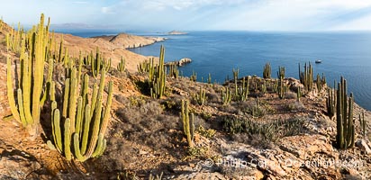
Aerial photo of Islas San Lorenzo in the Sea of Cortez. San Lorenzo Marine Archipelago National Park is a national park of Mexico located on San Lorenzo Island part of an archipelago in the Gulf of California off the eastern coast of Baja California. The San Lorenzo Archipelago is considered one of the most important ecological areas of the Gulf of California. The Island and surrounding areas are part of a rich ecosystem comprised by a grand variety of flora and marine fauna. This area is protected by the Mexican federal government Norma Oficial Mexicana because of its importance as a habitat for several endangered species.
Location: Islas San Lorenzo, Baja California, Mexico
Image ID: 40441
Location: Islas San Lorenzo, Baja California, Mexico
Image ID: 40441
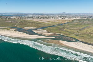
Aerial Photo of Tijuana River Mouth SMCA. Tijuana River Mouth State Marine Conservation Area borders Imperial Beach and the Mexican Border.
Location: Imperial Beach, California
Image ID: 30648
Location: Imperial Beach, California
Image ID: 30648
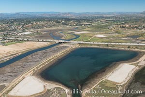
Aerial photo of San Dieguito Lagoon State Marine Conservation Area. San Dieguito Lagoon State Marine Conservation Area (SMCA) is a marine protected area near Del Mar in San Diego County.
Location: Del Mar, California
Image ID: 30607
Location: Del Mar, California
Image ID: 30607
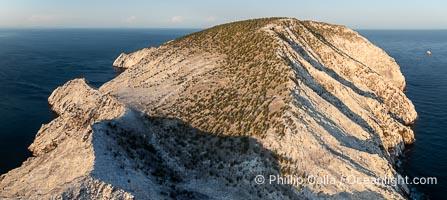
Isla San Pedro Martir at sunset with extensive forest of Cardon Cactus seen on the summit ridge of the island, aerial photo, Sea of Cortez, Mexico. San Pedro Martir Island and its marine life are, since 2002, part of the San Pedro Martir Biosphere Reserve, and is regarded as a natural laboratory of adaptive evolution, similar to that of the Galapagos Islands. It is home to 292 species of fauna and flora (both land-based and aquatic), with 42 species protected by Mexican law, and 30 listed on the Red List of Threatened Species. San Pedro Martir is also unique in the area for its year-round quantity of birds. The island is the only island in the area with a perpetually swirling cloud of sea birds. This is because the water around the island, has some of the most successful marine productivity in the world.
Species: Cardon cactus, Elephant cactus, Pachycereus pringlei
Location: Isla San Pedro Martir, Sonora, Mexico
Image ID: 40398
Species: Cardon cactus, Elephant cactus, Pachycereus pringlei
Location: Isla San Pedro Martir, Sonora, Mexico
Image ID: 40398
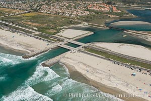
Aerial photo of Batiquitos Lagoon, Carlsbad. The Batiquitos Lagoon is a coastal wetland in southern Carlsbad, California. Part of the lagoon is designated as the Batiquitos Lagoon State Marine Conservation Area, run by the California Department of Fish and Game as a nature reserve.
Location: Carlsbad, Callifornia
Image ID: 30556
Location: Carlsbad, Callifornia
Image ID: 30556
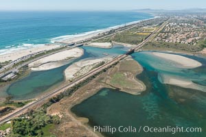
Aerial photo of Batiquitos Lagoon, Carlsbad. The Batiquitos Lagoon is a coastal wetland in southern Carlsbad, California. Part of the lagoon is designated as the Batiquitos Lagoon State Marine Conservation Area, run by the California Department of Fish and Game as a nature reserve.
Location: Carlsbad, Callifornia
Image ID: 30558
Location: Carlsbad, Callifornia
Image ID: 30558
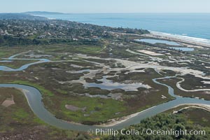
Aerial Photo of San Elijo Lagoon. San Elijo Lagoon Ecological Reserve is one of the largest remaining coastal wetlands in San Diego County, California, on the border of Encinitas, Solana Beach and Rancho Santa Fe.
Location: Encinitas, California
Image ID: 30592
Location: Encinitas, California
Image ID: 30592
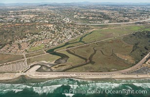
Aerial photo of Los Penasquitos Lagoon. Los Peñasquitos Marsh Natural Preserve and Lagoon is a coastal marsh in San Diego County, California, USA situated at the northern edge of the City of San Diego, forming the natural border with Del Mar, California.
Location: Del Mar, California
Image ID: 30602
Location: Del Mar, California
Image ID: 30602
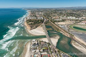
Aerial photo of San Dieguito Lagoon and Dog Beach. San Dieguito Lagoon State Marine Conservation Area (SMCA) is a marine protected area near Del Mar in San Diego County.
Location: Del Mar, California
Image ID: 30605
Location: Del Mar, California
Image ID: 30605
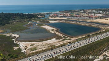
Aerial photo of San Dieguito Lagoon State Marine Conservation Area. San Dieguito Lagoon State Marine Conservation Area (SMCA) is a marine protected area near Del Mar in San Diego County.
Location: Del Mar, California
Image ID: 30609
Location: Del Mar, California
Image ID: 30609
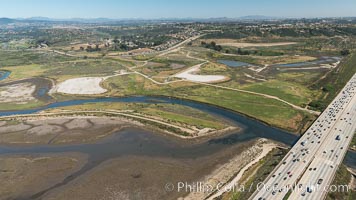
Aerial photo of San Dieguito Lagoon State Marine Conservation Area. San Dieguito Lagoon State Marine Conservation Area (SMCA) is a marine protected area near Del Mar in San Diego County.
Location: Del Mar, California
Image ID: 30614
Location: Del Mar, California
Image ID: 30614
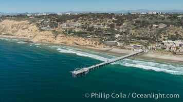
Aerial Photo of San Diego Scripps Coastal SMCA. Scripps Institution of Oceanography Research Pier.
Location: Scripps Institution of Oceanography, La Jolla, California
Image ID: 30627
Location: Scripps Institution of Oceanography, La Jolla, California
Image ID: 30627
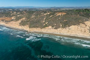
Torrey Pines seacliffs, rising up to 300 feet above the ocean, stretch from Del Mar to La Jolla. On the mesa atop the bluffs are found Torrey pine trees, one of the rare species of pines in the world.
Location: Torrey Pines State Reserve, San Diego, California
Image ID: 30673
Location: Torrey Pines State Reserve, San Diego, California
Image ID: 30673
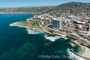
Aerial Photo of La Jolla coastline, showing underwater reefs and Mount Soledad.
Location: La Jolla, California
Image ID: 30676
Location: La Jolla, California
Image ID: 30676
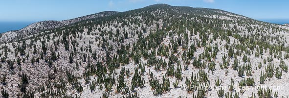
Extensive Forest of Cardon Cactus on the Summit Ridge of San Pedro Martir Island, Sea of Cortez, Mexico. The island and its marine life are, since 2002, part of the San Pedro Martir Biosphere Reserve, and is regarded as a natural laboratory of adaptive evolution, similar to that of the Galapagos Islands. It is home to 292 species of fauna and flora (both land-based and aquatic), with 42 species protected by Mexican law, and 30 listed on the Red List of Threatened Species. San Pedro Martir is also unique in the area for its year-round quantity of birds. The island is the only island in the area with a perpetually swirling cloud of sea birds. This is because the water around the island, has some of the most successful marine productivity in the world.
Location: Isla San Pedro Martir, Sonora, Mexico
Image ID: 40386
Panorama dimensions: 3391 x 10022
Location: Isla San Pedro Martir, Sonora, Mexico
Image ID: 40386
Panorama dimensions: 3391 x 10022
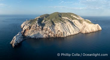
Isla San Pedro Martir aerial photo, Sea of Cortez, Mexico. San Pedro Martir Island and its marine life are, since 2002, part of the San Pedro Martir Biosphere Reserve, and is regarded as a natural laboratory of adaptive evolution, similar to that of the Galapagos Islands. It is home to 292 species of fauna and flora (both land-based and aquatic), with 42 species protected by Mexican law, and 30 listed on the Red List of Threatened Species. San Pedro Martir is also unique in the area for its year-round quantity of birds. The island is the only island in the area with a perpetually swirling cloud of sea birds. This is because the water around the island, has some of the most successful marine productivity in the world.
Location: Isla San Pedro Martir, Sonora, Mexico
Image ID: 40419
Location: Isla San Pedro Martir, Sonora, Mexico
Image ID: 40419
