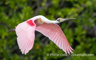
Roseate Spoonbill in Flight, Platalea ajaja, Alafia Banks, Florida.
Species: Roseate Spoonbill, Platalea ajaja
Location: Alafia Banks Critical Wildlife Area, Tampa, Florida
Image ID: 40537
Species: Roseate Spoonbill, Platalea ajaja
Location: Alafia Banks Critical Wildlife Area, Tampa, Florida
Image ID: 40537

The Botanical Building in Balboa Park, San Diego. The Botanical Building, at 250 feet long by 75 feet wide and 60 feet tall, was the largest wood lath structure in the world when it was built in 1915 for the Panama-California Exposition. The Botanical Building, located on the Prado, west of the Museum of Art, contains about 2,100 permanent tropical plants along with changing seasonal flowers. The Lily Pond, just south of the Botanical Building, is an eloquent example of the use of reflecting pools to enhance architecture. The 193' by 43' foot pond and smaller companion pool were originally referred to as Las Lagunas de las Flores (The Lakes of the Flowers) and were designed as aquatic gardens. The pools contain exotic water lilies and lotus which bloom spring through fall.
Location: Balboa Park, San Diego, California
Image ID: 28823
Location: Balboa Park, San Diego, California
Image ID: 28823
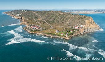
Aerial Photo of Cabrillo State Marine Reserve, Point Loma, San Diego.
Location: San Diego, California
Image ID: 30641
Location: San Diego, California
Image ID: 30641
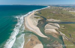
Aerial Photo of Tijuana River Mouth SMCA. Tijuana River Mouth State Marine Conservation Area borders Imperial Beach and the Mexican Border.
Location: Imperial Beach, California
Image ID: 30660
Location: Imperial Beach, California
Image ID: 30660

Panorama of the Wave. The Wave is a sweeping, dramatic display of eroded sandstone, forged by eons of water and wind erosion, laying bare striations formed from compacted sand dunes over millenia. This panoramic picture is formed from thirteen individual photographs.
Location: North Coyote Buttes, Paria Canyon-Vermilion Cliffs Wilderness, Arizona
Image ID: 20700
Panorama dimensions: 4661 x 25458
Location: North Coyote Buttes, Paria Canyon-Vermilion Cliffs Wilderness, Arizona
Image ID: 20700
Panorama dimensions: 4661 x 25458
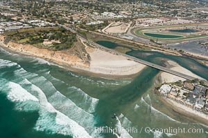
Aerial photo of San Dieguito Lagoon and Dog Beach. San Dieguito Lagoon State Marine Conservation Area (SMCA) is a marine protected area near Del Mar in San Diego County.
Location: Del Mar, California
Image ID: 30604
Location: Del Mar, California
Image ID: 30604
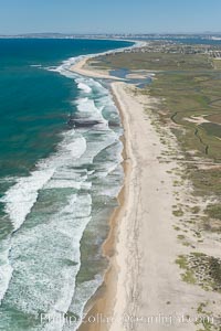
Aerial Photo of Tijuana River Mouth SMCA. Tijuana River Mouth State Marine Conservation Area borders Imperial Beach and the Mexican Border.
Location: Imperial Beach, California
Image ID: 30649
Location: Imperial Beach, California
Image ID: 30649
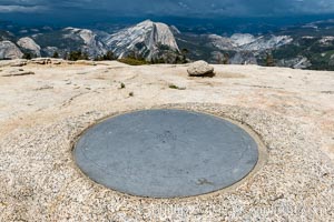
Sentinel Dome summit compass marker, with Half Dome in the distance, Yosemite National Park.
Location: Yosemite National Park, California
Image ID: 36363
Location: Yosemite National Park, California
Image ID: 36363
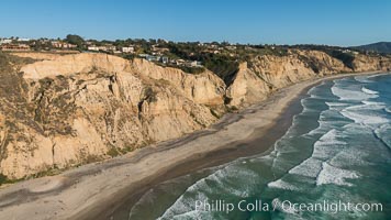
Aerial Photo of San Diego Scripps Coastal SMCA. Blacks Beach and Torrey Pines State Reserve.
Location: La Jolla, California
Image ID: 30736
Location: La Jolla, California
Image ID: 30736
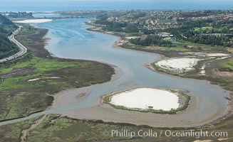
Aerial photo of Batiquitos Lagoon, Carlsbad. The Batiquitos Lagoon is a coastal wetland in southern Carlsbad, California. Part of the lagoon is designated as the Batiquitos Lagoon State Marine Conservation Area, run by the California Department of Fish and Game as a nature reserve.
Location: Carlsbad, Callifornia
Image ID: 30563
Location: Carlsbad, Callifornia
Image ID: 30563
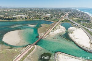
Aerial photo of Batiquitos Lagoon, Carlsbad. The Batiquitos Lagoon is a coastal wetland in southern Carlsbad, California. Part of the lagoon is designated as the Batiquitos Lagoon State Marine Conservation Area, run by the California Department of Fish and Game as a nature reserve.
Location: Carlsbad, Callifornia
Image ID: 30569
Location: Carlsbad, Callifornia
Image ID: 30569
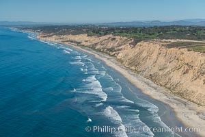
Aerial Photo of San Diego Scripps Coastal SMCA. Blacks Beach and Torrey Pines State Reserve.
Location: La Jolla, California
Image ID: 30622
Location: La Jolla, California
Image ID: 30622
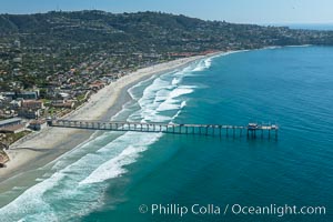
Aerial Photo of San Diego Scripps Coastal SMCA. Scripps Institution of Oceanography Research Pier.
Location: Scripps Institution of Oceanography, La Jolla, California
Image ID: 30626
Location: Scripps Institution of Oceanography, La Jolla, California
Image ID: 30626
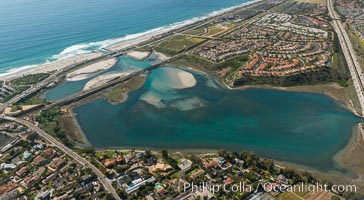
Aerial photo of Batiquitos Lagoon, Carlsbad. The Batiquitos Lagoon is a coastal wetland in southern Carlsbad, California. Part of the lagoon is designated as the Batiquitos Lagoon State Marine Conservation Area, run by the California Department of Fish and Game as a nature reserve.
Location: Carlsbad, Callifornia
Image ID: 30665
Location: Carlsbad, Callifornia
Image ID: 30665
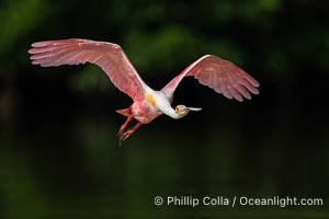
Roseate Spoonbill in Flight, Platalea ajaja, Alafia Banks, Florida.
Species: Roseate Spoonbill, Platalea ajaja
Location: Alafia Banks Critical Wildlife Area, Tampa, Florida
Image ID: 40542
Species: Roseate Spoonbill, Platalea ajaja
Location: Alafia Banks Critical Wildlife Area, Tampa, Florida
Image ID: 40542
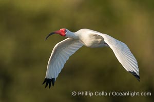
White Ibis in flight, Eudocimus albus, Alafia Banks, Florida.
Species: White Ibis, Eudocimus albus
Location: Alafia Banks Critical Wildlife Area, Tampa, Florida
Image ID: 40546
Species: White Ibis, Eudocimus albus
Location: Alafia Banks Critical Wildlife Area, Tampa, Florida
Image ID: 40546
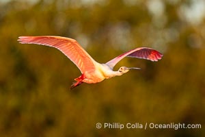
Roseate Spoonbill in Flight, Platalea ajaja, Alafia Banks, Florida.
Species: Roseate Spoonbill, Platalea ajaja
Location: Alafia Banks Critical Wildlife Area, Tampa, Florida
Image ID: 40548
Species: Roseate Spoonbill, Platalea ajaja
Location: Alafia Banks Critical Wildlife Area, Tampa, Florida
Image ID: 40548
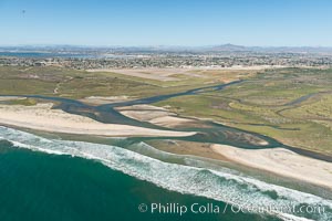
Aerial Photo of Tijuana River Mouth SMCA. Tijuana River Mouth State Marine Conservation Area borders Imperial Beach and the Mexican Border.
Location: Imperial Beach, California
Image ID: 30648
Location: Imperial Beach, California
Image ID: 30648
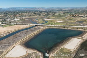
Aerial photo of San Dieguito Lagoon State Marine Conservation Area. San Dieguito Lagoon State Marine Conservation Area (SMCA) is a marine protected area near Del Mar in San Diego County.
Location: Del Mar, California
Image ID: 30607
Location: Del Mar, California
Image ID: 30607
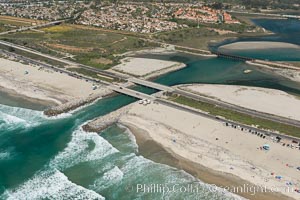
Aerial photo of Batiquitos Lagoon, Carlsbad. The Batiquitos Lagoon is a coastal wetland in southern Carlsbad, California. Part of the lagoon is designated as the Batiquitos Lagoon State Marine Conservation Area, run by the California Department of Fish and Game as a nature reserve.
Location: Carlsbad, Callifornia
Image ID: 30556
Location: Carlsbad, Callifornia
Image ID: 30556
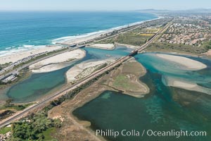
Aerial photo of Batiquitos Lagoon, Carlsbad. The Batiquitos Lagoon is a coastal wetland in southern Carlsbad, California. Part of the lagoon is designated as the Batiquitos Lagoon State Marine Conservation Area, run by the California Department of Fish and Game as a nature reserve.
Location: Carlsbad, Callifornia
Image ID: 30558
Location: Carlsbad, Callifornia
Image ID: 30558
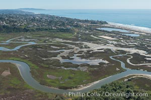
Aerial Photo of San Elijo Lagoon. San Elijo Lagoon Ecological Reserve is one of the largest remaining coastal wetlands in San Diego County, California, on the border of Encinitas, Solana Beach and Rancho Santa Fe.
Location: Encinitas, California
Image ID: 30592
Location: Encinitas, California
Image ID: 30592
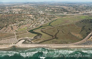
Aerial photo of Los Penasquitos Lagoon. Los Peñasquitos Marsh Natural Preserve and Lagoon is a coastal marsh in San Diego County, California, USA situated at the northern edge of the City of San Diego, forming the natural border with Del Mar, California.
Location: Del Mar, California
Image ID: 30602
Location: Del Mar, California
Image ID: 30602
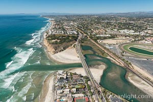
Aerial photo of San Dieguito Lagoon and Dog Beach. San Dieguito Lagoon State Marine Conservation Area (SMCA) is a marine protected area near Del Mar in San Diego County.
Location: Del Mar, California
Image ID: 30605
Location: Del Mar, California
Image ID: 30605
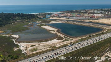
Aerial photo of San Dieguito Lagoon State Marine Conservation Area. San Dieguito Lagoon State Marine Conservation Area (SMCA) is a marine protected area near Del Mar in San Diego County.
Location: Del Mar, California
Image ID: 30609
Location: Del Mar, California
Image ID: 30609
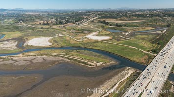
Aerial photo of San Dieguito Lagoon State Marine Conservation Area. San Dieguito Lagoon State Marine Conservation Area (SMCA) is a marine protected area near Del Mar in San Diego County.
Location: Del Mar, California
Image ID: 30614
Location: Del Mar, California
Image ID: 30614
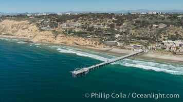
Aerial Photo of San Diego Scripps Coastal SMCA. Scripps Institution of Oceanography Research Pier.
Location: Scripps Institution of Oceanography, La Jolla, California
Image ID: 30627
Location: Scripps Institution of Oceanography, La Jolla, California
Image ID: 30627
