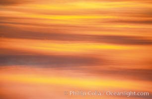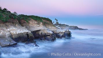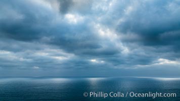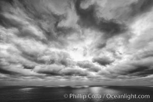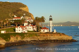
New Point Loma Lighthouse, situated on the tip of Point Loma Peninsula, marks the entrance to San Diego Bay. The lighthouse rises 70' and was built in 1891 to replace the "old" Point Loma Lighthouse which was often shrouded in fog.
Location: San Diego, California
Image ID: 22295
Location: San Diego, California
Image ID: 22295
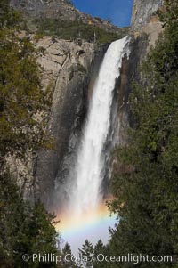
Bridalveil Falls with a rainbow forming in its spray, dropping 620 into Yosemite Valley, displaying peak water flow in spring months from deep snowpack and warm weather melt. Yosemite Valley.
Location: Bridalveil Falls, Yosemite National Park, California
Image ID: 16160
Location: Bridalveil Falls, Yosemite National Park, California
Image ID: 16160
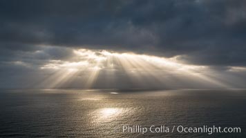
God Beams, clouds and afternoon light over the Pacific Ocean.
Location: Del Mar, California
Image ID: 28479
Location: Del Mar, California
Image ID: 28479
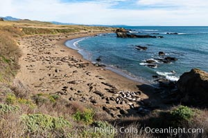
Elephant seals crowd a sand beach at the Piedras Blancas rookery near San Simeon.
Location: Piedras Blancas, San Simeon, California
Image ID: 35140
Location: Piedras Blancas, San Simeon, California
Image ID: 35140
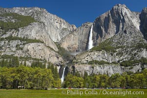
Yosemite Falls rises above Cooks Meadow. The 2425 falls, the tallest in North America, is at peak flow during a warm-weather springtime melt of Sierra snowpack. Yosemite Valley.
Location: Yosemite Falls, Yosemite National Park, California
Image ID: 16141
Location: Yosemite Falls, Yosemite National Park, California
Image ID: 16141
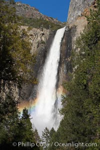
Bridalveil Falls with a rainbow forming in its spray, dropping 620 into Yosemite Valley, displaying peak water flow in spring months from deep snowpack and warm weather melt. Yosemite Valley.
Location: Bridalveil Falls, Yosemite National Park, California
Image ID: 16175
Location: Bridalveil Falls, Yosemite National Park, California
Image ID: 16175
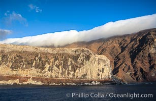
Clouds held back by island crest.
Location: Guadalupe Island (Isla Guadalupe), Baja California, Mexico
Image ID: 03848
Location: Guadalupe Island (Isla Guadalupe), Baja California, Mexico
Image ID: 03848
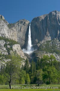
Yosemite Falls rises above Cooks Meadow. The 2425 falls, the tallest in North America, is at peak flow during a warm-weather springtime melt of Sierra snowpack. Yosemite Valley.
Location: Yosemite Falls, Yosemite National Park, California
Image ID: 16136
Location: Yosemite Falls, Yosemite National Park, California
Image ID: 16136
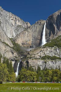
Yosemite Falls rises above Cooks Meadow. The 2425 falls, the tallest in North America, is at peak flow during a warm-weather springtime melt of Sierra snowpack. Yosemite Valley.
Location: Yosemite Falls, Yosemite National Park, California
Image ID: 16138
Location: Yosemite Falls, Yosemite National Park, California
Image ID: 16138
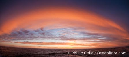
Sunset clouds create a colorful arch, spanning the heavens from horizon to horizon, over the open sea between the Falkland Islands and South Georgia Island.
Location: Southern Ocean
Image ID: 24073
Location: Southern Ocean
Image ID: 24073
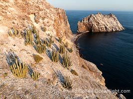
Rugged Terrain of Isla San Pedro Martir, Sea of Cortez. Aerial photo. The large bird population deposits enormous quantities of guano on the island, resulting in the white appearance of the island contrasted with sparse vegetation. In the late 19th and early 20th century guano was heavily mined off the island and shipped as far as Europe for use as fertilizer. San Pedro Martir is seldom visited, having near vertical sides leaving only questionable fair weather anchorages in two locations. Landing access was possible near a small isthmus in the southeast of the island, but is now forbidden. In 2005, the island was classified along with 244 others as a World Heritage Site by UNESCO, and included in the Islands and Protected Areas of the Gulf of California.
Location: Isla San Pedro Martir, Sonora, Mexico
Image ID: 40400
Location: Isla San Pedro Martir, Sonora, Mexico
Image ID: 40400
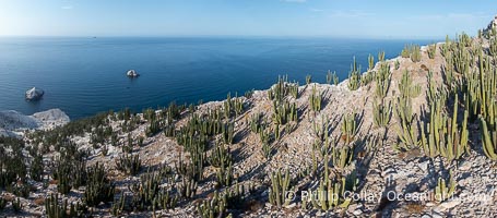
Rugged Terrain of Isla San Pedro Martir, Sea of Cortez. Aerial photo. The large bird population deposits enormous quantities of guano on the island, resulting in the white appearance of the island contrasted with sparse vegetation. In the late 19th and early 20th century guano was heavily mined off the island and shipped as far as Europe for use as fertilizer. San Pedro Martir is seldom visited, having near vertical sides leaving only questionable fair weather anchorages in two locations. Landing access was possible near a small isthmus in the southeast of the island, but is now forbidden. In 2005, the island was classified along with 244 others as a World Heritage Site by UNESCO, and included in the Islands and Protected Areas of the Gulf of California.
Location: Isla San Pedro Martir, Sonora, Mexico
Image ID: 40421
Panorama dimensions: 4451 x 10130
Location: Isla San Pedro Martir, Sonora, Mexico
Image ID: 40421
Panorama dimensions: 4451 x 10130
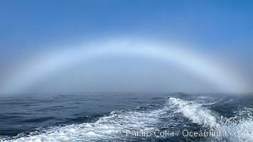
A fog bow, sometimes called a white rainbow, is a similar phenomenon to a rainbow; however, as its name suggests, it appears as a bow in fog rather than rain.
Location: Coronado Islands (Islas Coronado), Baja California, Mexico
Image ID: 38578
Location: Coronado Islands (Islas Coronado), Baja California, Mexico
Image ID: 38578
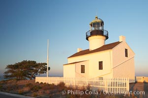
The old Point Loma lighthouse operated from 1855 to 1891 above the entrance to San Diego Bay. It is now a maintained by the National Park Service and is part of Cabrillo National Monument.
Location: Cabrillo National Monument, San Diego, California
Image ID: 14522
Location: Cabrillo National Monument, San Diego, California
Image ID: 14522
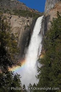
Bridalveil Falls with a rainbow forming in its spray, dropping 620 into Yosemite Valley, displaying peak water flow in spring months from deep snowpack and warm weather melt. Yosemite Valley.
Location: Bridalveil Falls, Yosemite National Park, California
Image ID: 16176
Location: Bridalveil Falls, Yosemite National Park, California
Image ID: 16176
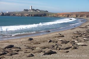
Elephant seals crowd a sand beach at the Piedras Blancas rookery near San Simeon. The Piedras Blancas lighthouse is visible in upper left.
Location: Piedras Blancas, San Simeon, California
Image ID: 20355
Location: Piedras Blancas, San Simeon, California
Image ID: 20355
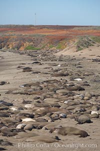
Elephant seals crowd a sand beach at the Piedras Blancas rookery near San Simeon.
Location: Piedras Blancas, San Simeon, California
Image ID: 20358
Location: Piedras Blancas, San Simeon, California
Image ID: 20358

Guadalupe Island at sunrise, panorama. Volcanic coastline south of Pilot Rock and Spanish Cove, near El Faro lighthouse.
Location: Guadalupe Island (Isla Guadalupe), Baja California, Mexico
Image ID: 19497
Panorama dimensions: 2797 x 16157
Location: Guadalupe Island (Isla Guadalupe), Baja California, Mexico
Image ID: 19497
Panorama dimensions: 2797 x 16157
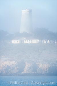
Piedras Blancas lighthouse. Completed in 1875, the 115-foot-tall Piedras Blancas lighthouse is one of the few tall-style lighthouses on the West Coast of the United States. Piedras Blancas, named for a group of three white rocks just offshore, is north of San Simeon, California very close to Hearst Castle.
Location: Piedras Blancas, San Simeon, California
Image ID: 20348
Location: Piedras Blancas, San Simeon, California
Image ID: 20348
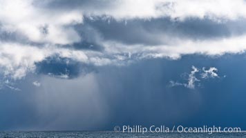
Clouds, weather and light mix in neverending forms over the open ocean of Scotia Sea, in the Southern Ocean.
Location: Scotia Sea, Southern Ocean
Image ID: 24757
Location: Scotia Sea, Southern Ocean
Image ID: 24757
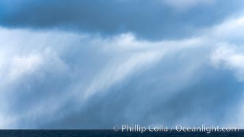
Clouds, weather and light mix in neverending forms over the open ocean of Scotia Sea, in the Southern Ocean.
Location: Scotia Sea, Southern Ocean
Image ID: 24758
Location: Scotia Sea, Southern Ocean
Image ID: 24758
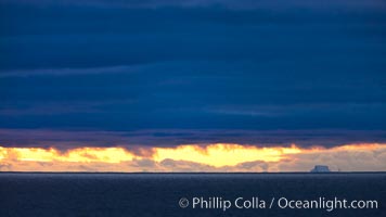
Clouds, weather and light mix in neverending forms over the open ocean of Scotia Sea, in the Southern Ocean.
Location: Scotia Sea, Southern Ocean
Image ID: 24759
Location: Scotia Sea, Southern Ocean
Image ID: 24759
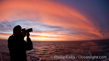
Photographer takes picture of a spectacular sunset arch, spanning the heavens from horizon to horizon, over the open sea between the Falkland Islands and South Georgia Island.
Location: Southern Ocean
Image ID: 24096
Location: Southern Ocean
Image ID: 24096
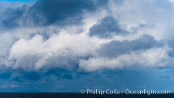
Clouds, weather and light mix in neverending forms over the open ocean of Scotia Sea, in the Southern Ocean.
Location: Scotia Sea, Southern Ocean
Image ID: 24760
Location: Scotia Sea, Southern Ocean
Image ID: 24760
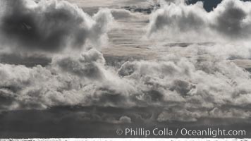
Clouds, weather and light mix in neverending forms over the open ocean of Scotia Sea, in the Southern Ocean.
Location: Scotia Sea, Southern Ocean
Image ID: 24761
Location: Scotia Sea, Southern Ocean
Image ID: 24761
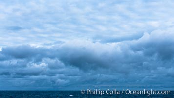
Clouds, weather and light mix in neverending forms over the open ocean of Scotia Sea, in the Southern Ocean.
Location: Scotia Sea, Southern Ocean
Image ID: 24762
Location: Scotia Sea, Southern Ocean
Image ID: 24762
